About this Study
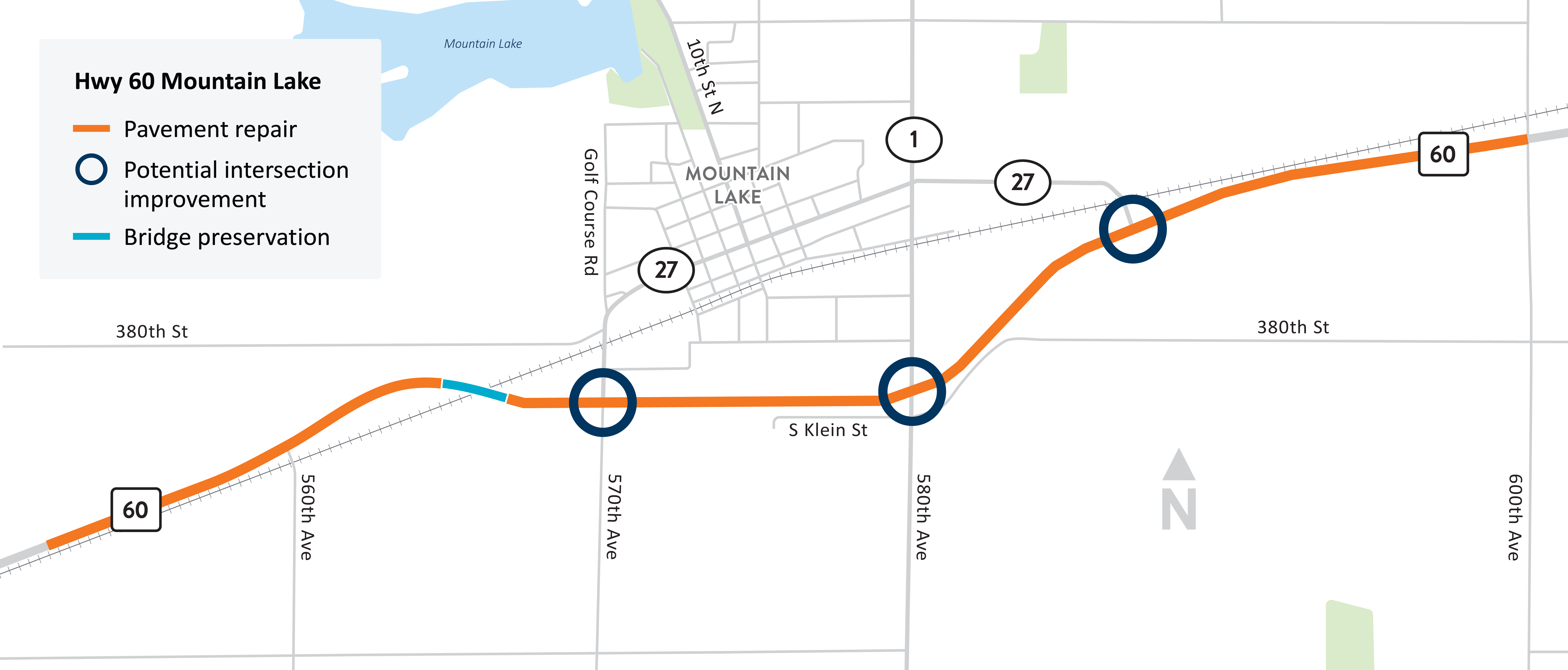
Hwy 60 Mountain Lake Study location. View full-size map.
MnDOT is developing a future project on Hwy 60 near Mountain Lake. Beyond pavement needs, MnDOT is studying the project area for opportunities to improve safety and traffic flow at three key Cottonwood County intersections:
- Hwy 60 and Co. Rd. 27 on the west end
- Hwy 60 and Co. Rd. 1
- Hwy 60 and Co. Rd 27 on the east end
In collaboration with Cottonwood County, the City of Mountain Lake, and input from the community, MnDOT evaluated the corridor and developed design alternatives that would be future project. The Study identified five alternatives to include in the final report. Two alternatives fit within the funding constraints of MnDOT District 7's program budget, and three alternatives are high-end, more complex concepts that would require alternative funding sources.
A future Hwy 60 Mountain Lake project is within MnDOT's 10-year program. As that approaches, the various alternatives from the Study will be revisited to determine what best fits the needs with the funding available.
The Hwy 60 Mountain Lake Study materials can be viewed here: