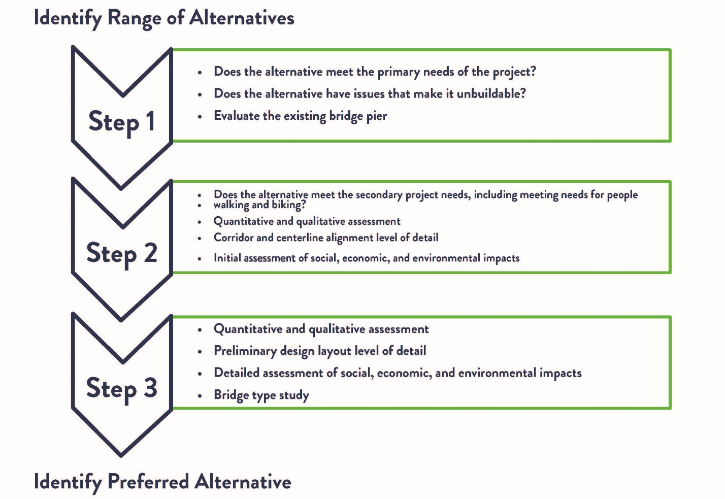
A three-step process is being used to evaluate bridge crossing alternatives and select a preferred project alternative for the Osceola Bridge. This process began with identifying a reasonable range of build concepts, including a no-build alternative. Each step refined the alternatives through quantitative and qualitative environmental analysis. Each step looked at the remaining alternatives at a progressively greater level of detail. The outcome of the third step is the identification of a preferred alternative, which is the alternative that will proceed into final design and ultimately construction for the Hwy 243 Osceola Bridge project.
Bridge concepts were evaluated using the criteria outlined in the Alternatives Evaluation Criteria document. Initial criteria include Bridge Condition and Structure Robustness. Additional criteria include bikeability/walkability, Social, Economic and Environmental considerations, and other factors like constructability and ability to reduce traffic impacts during construction.
There were eight concepts screened in step 1. Four of these initial concepts were removed after the first screening for not meeting the project criteria. The Step 2 analysis looked at the remaining 4 build alternatives, which were included the option of doing nothing also known as the “no-build” concept. The results of the Step 2 analysis, which were presented to the public in 2022, indicated that there was not adequate information at that level of design to differentiate among the four remaining build alternatives to justify eliminating any of them. Therefore, all four build alternatives considered in Step 2 were carried forward for further evaluation in to Step 3.
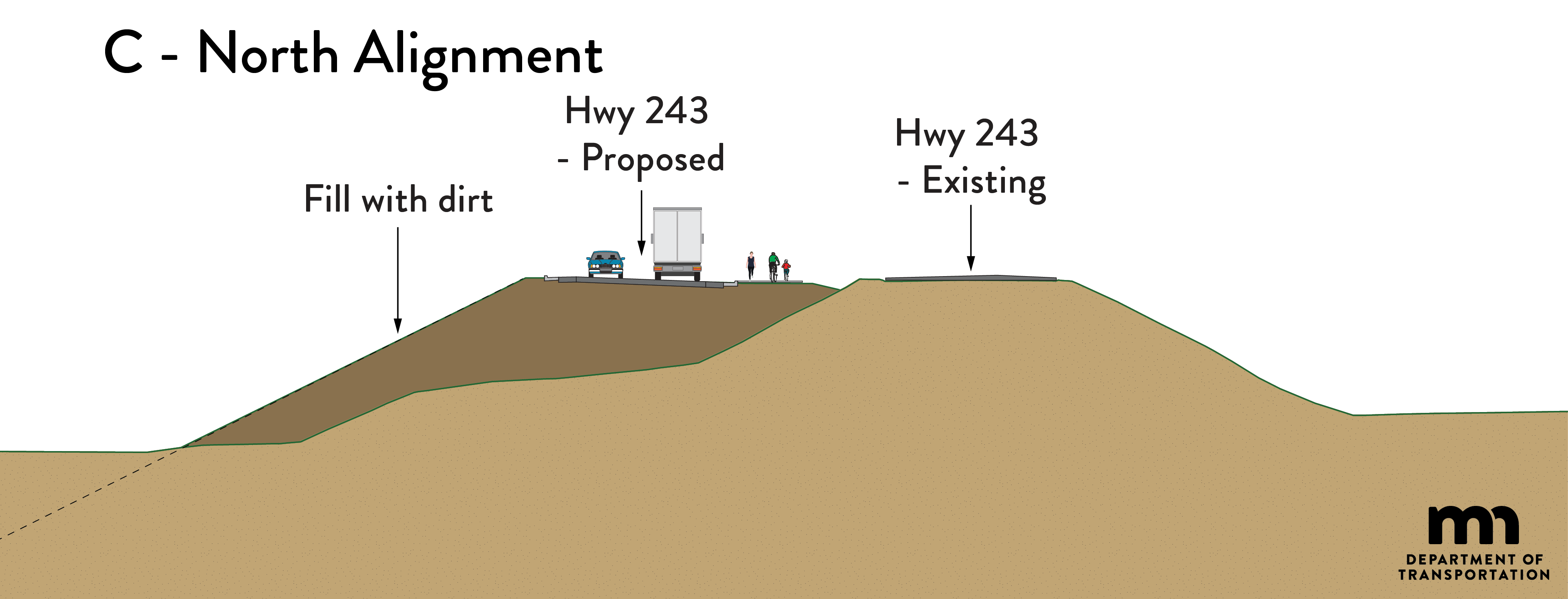
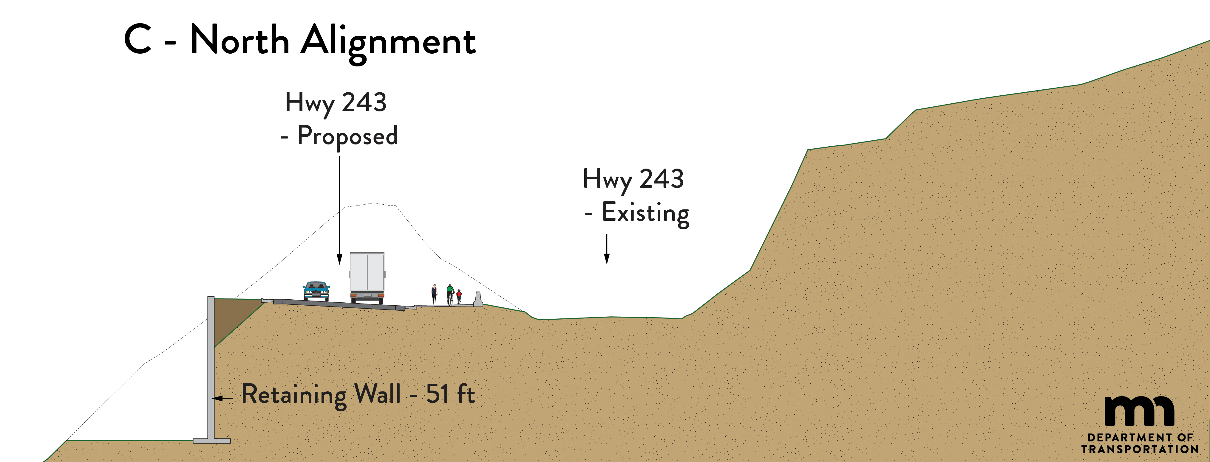
In Step 3, the “no-build” and three build alternatives were evaluated in greater detail. The team considered geology, trail and road widths, the impacts to the St. Croix River, the Wilke Glen Cascade Falls area and area bluffs. Visualization images were created for each of the three alternatives. The project team completed the more extensive step 3 study and identified a recommended alignment, concept B.
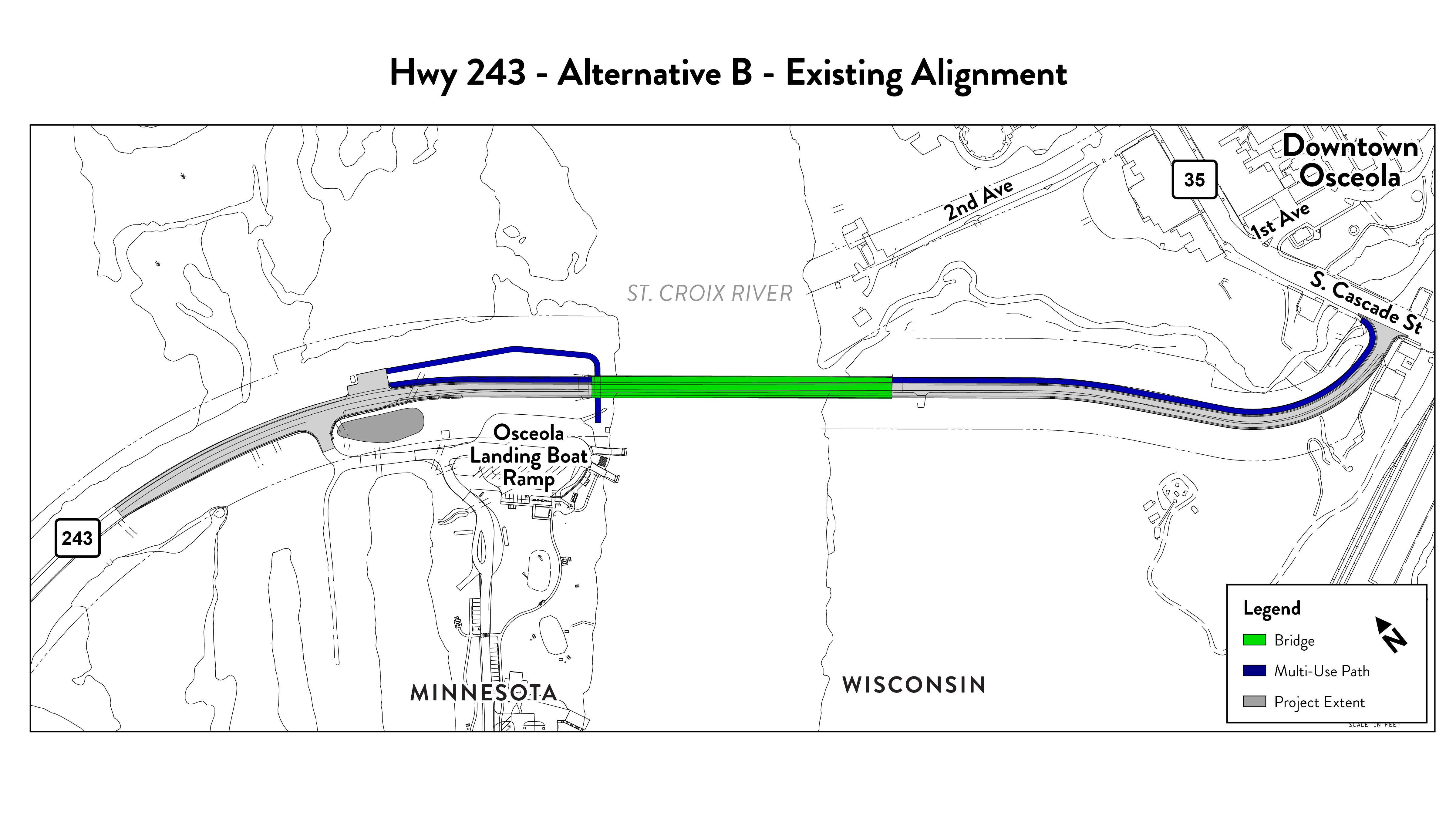
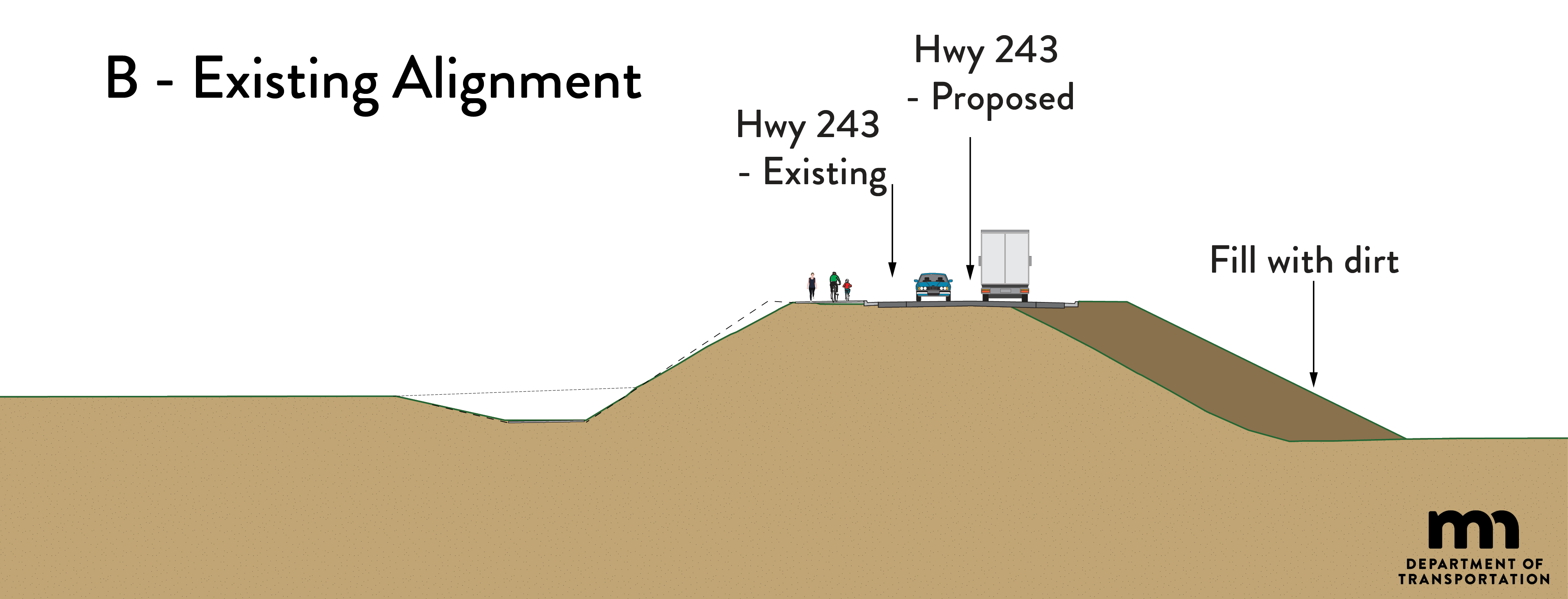
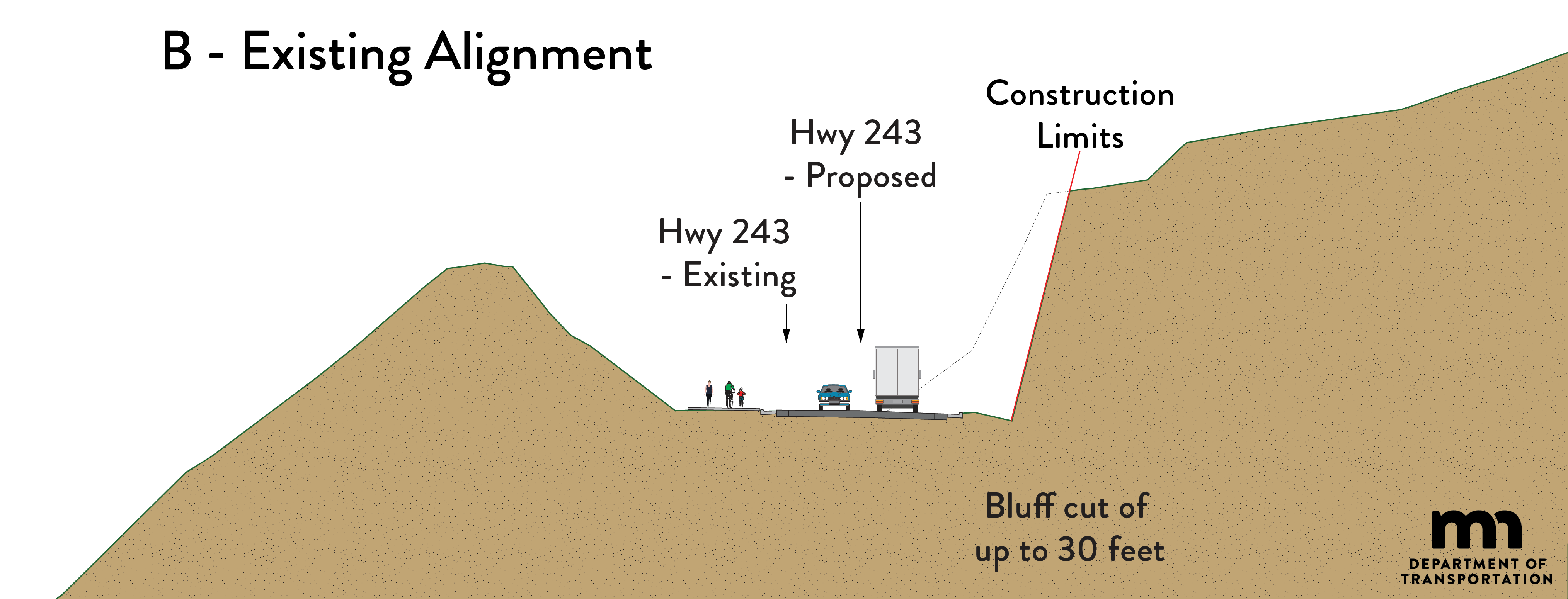
Build alternative B, existing alignment
Click image for larger versionMinnesota side Click image for larger versionWisconsin side Click image for larger version
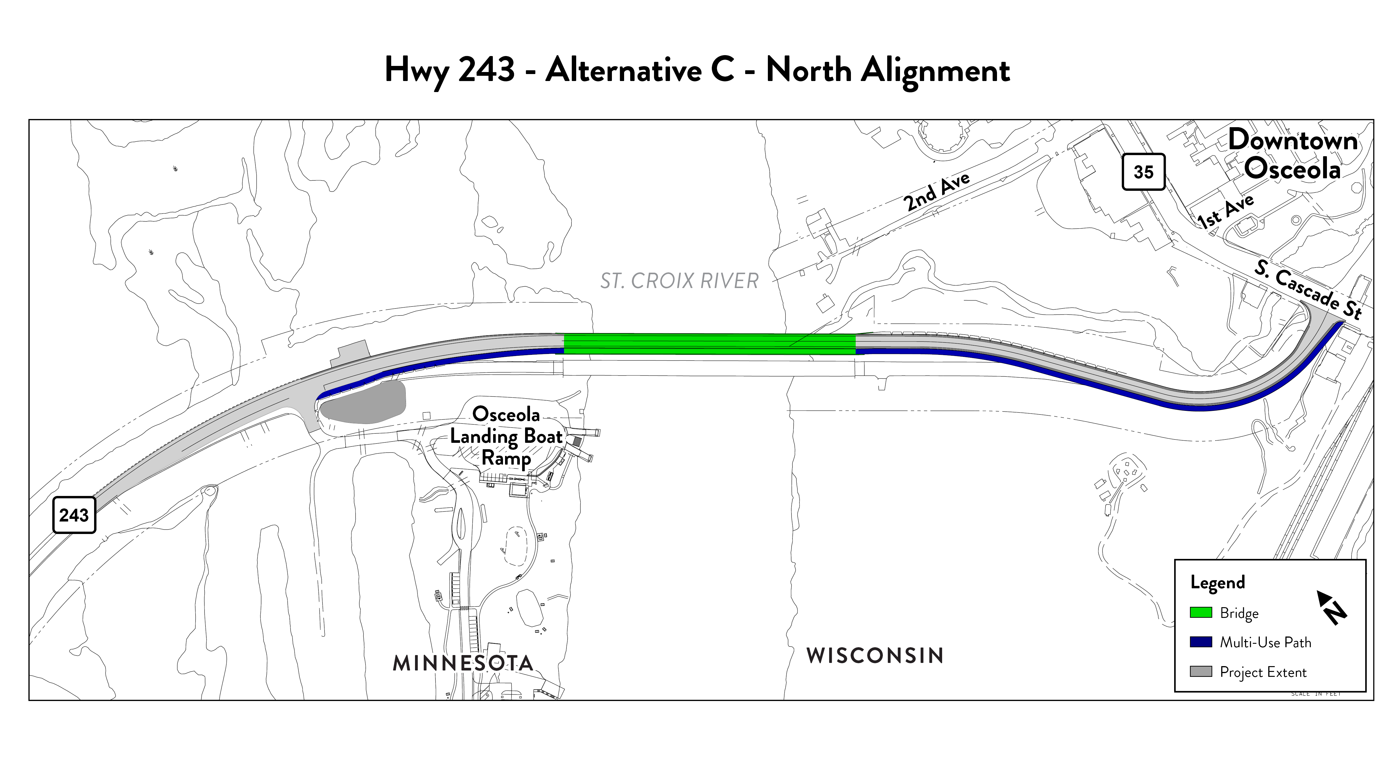
Build alternative C, north alignment
Click image for larger versionMinnesota side Click image for larger versionWisconsin side Click image for larger version
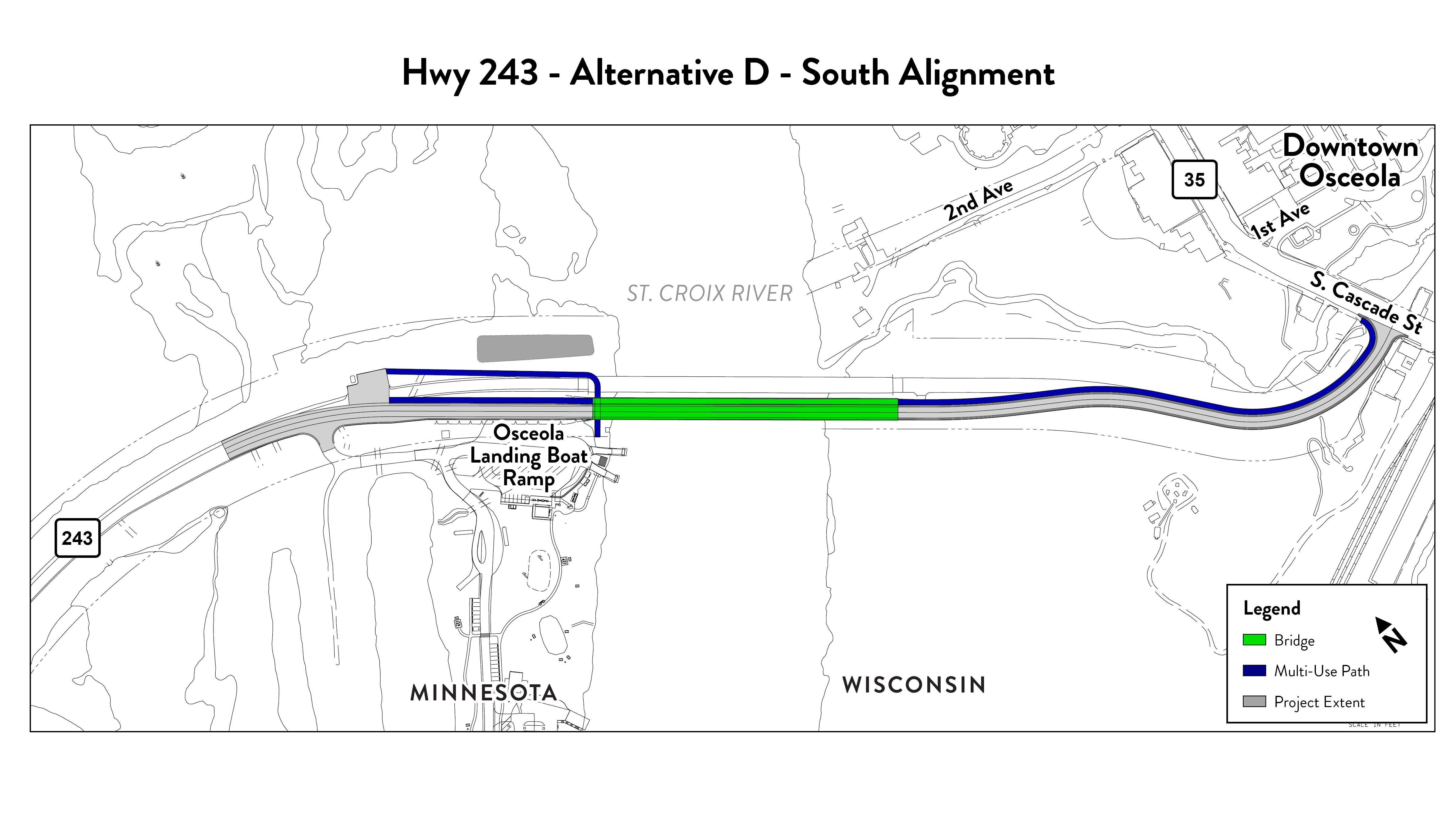
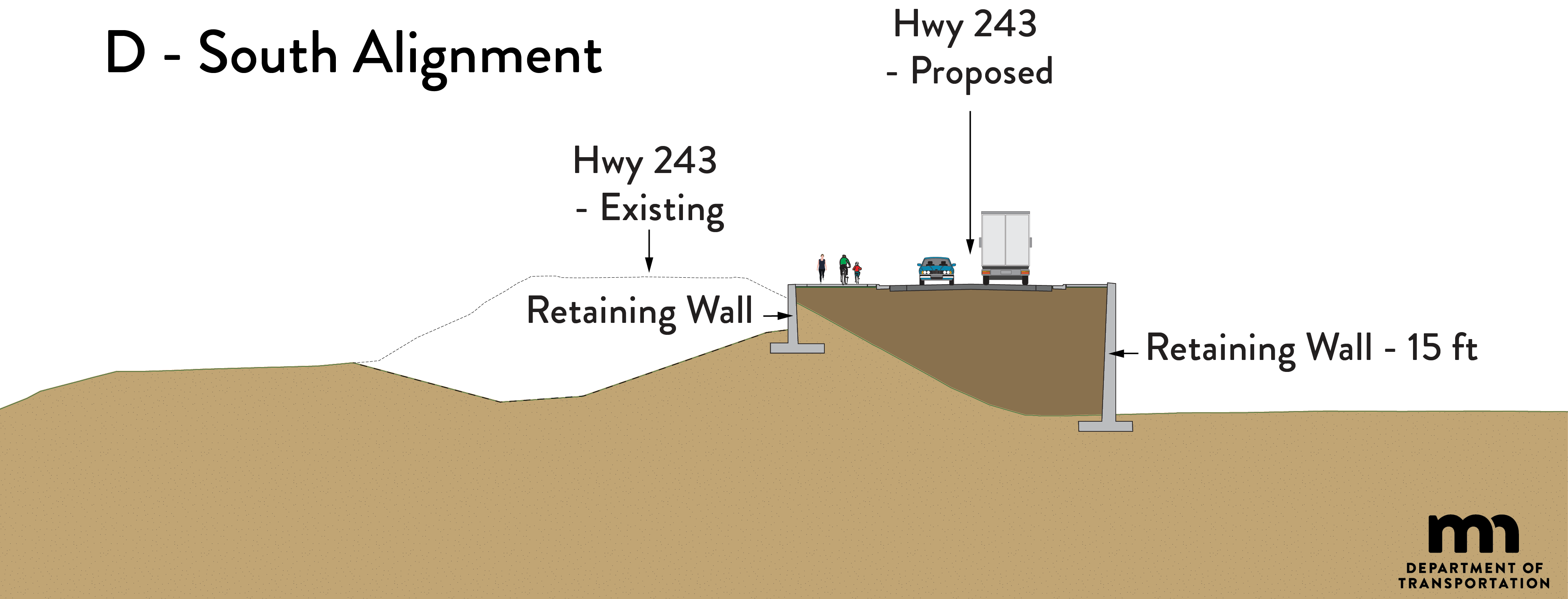
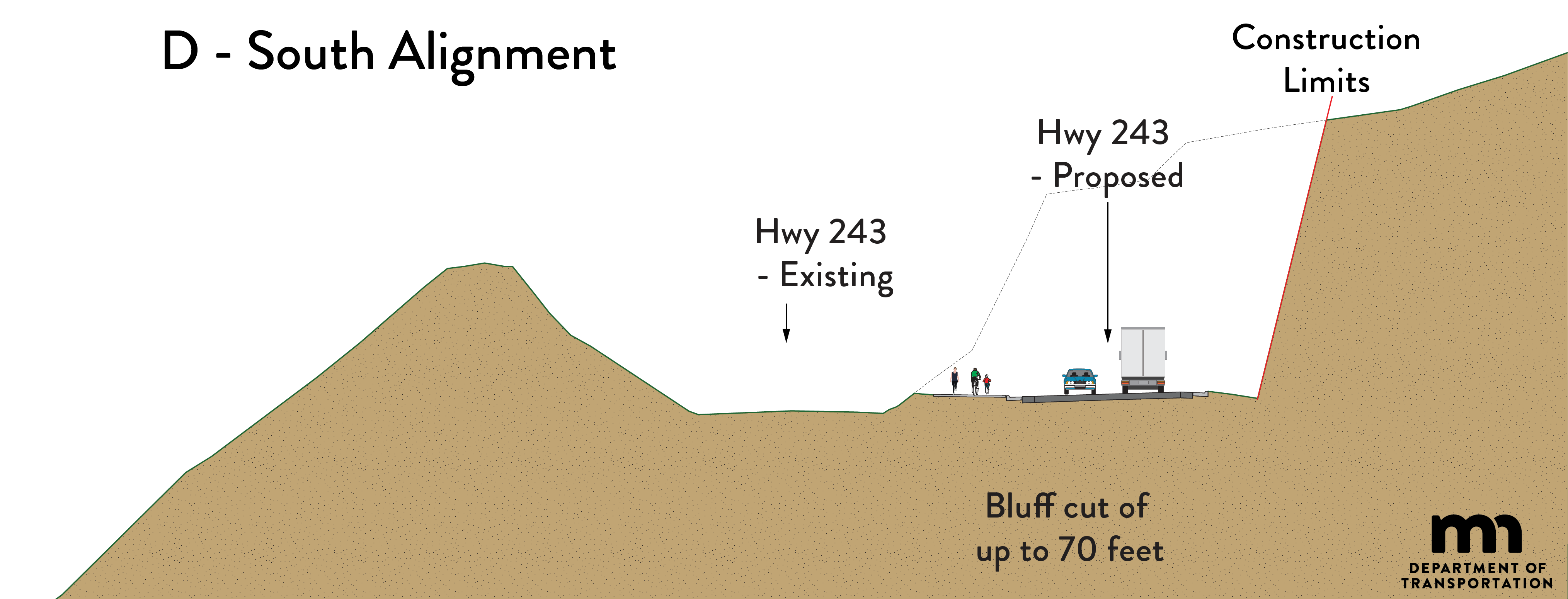
Build alternative D, south alignment
Click image for larger versionMinnesota side Click image for larger versionWisconsin side Click image for larger version
Concepts considered in step 1
Click image for larger version
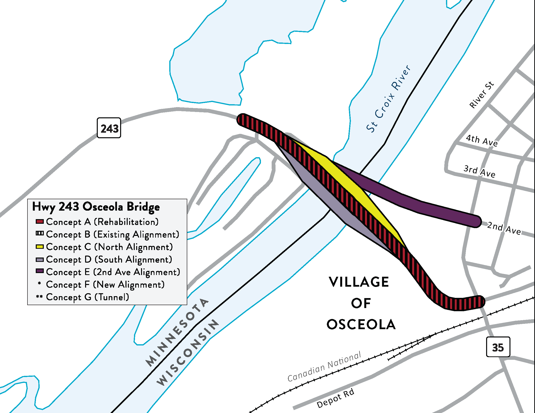
A total of eight project concepts were considered in step 1 of the process. These alternatives are included on the map below. Descriptions follow.
No-Build Alternative: The No-Build Alternative (or “do nothing” alternative) includes routine bridge maintenance activities on the existing Hwy 243 Bridge. The existing bridge deck, superstructure, and piers would be left as-is.
Build Concept A: Concept A includes removal of the existing Hwy 243 bridge deck and superstructure and replacement with a new deck and superstructure. The existing bridge
piers would remain-in-place and be re-used with the rehabilitation concept.
Build Concept B: Concept B includes removing the existing Hwy 243 Bridge and constructing a new bridge and approach roadways along the existing alignment.
Build Concept C: Concept C includes constructing a new bridge parallel to the existing Hwy 243 bridge. The new bridge would be built to the north of the existing bridge. The existing Hwy 243 Bridge would be removed following construction of the new bridge.
Build Concept D: Concept D includes constructing a new bridge crossing parallel to the existing Hwy 243 bridge. The new bridge would be built to the south of the existing bridge. The existing Hwy 243 Bridge would be removed following construction of the new bridge.
Build Concept E: Concept E includes constructing a new bridge crossing north of the existing Hwy 243 bridge and realigning Hwy 23 on the Wisconsin Side to connect to the existing 2nd Avenue. The existing Hwy 243 Bridge and approach would be removed following construction of the new bridge.
Build Concept F: Concept F includes constructing a new bridge crossing along an entirely new Hwy 243 alignment between MN Hwy 95 and WI Hwy 35 outside of the Village of Osceola. The existing Hwy 243 Bridge would be removed following construction of the new bridge.
Build Concept G: Concept G includes constructing a tunnel under the St. Croix River along the existing Hwy 243 alignment from Minnesota to Wisconsin. The existing Hwy 243 Bridge would be removed following construction of the tunnel.