In the first phase, community members were asked about their experiences traveling along and across the highway. Over 1,000 postcards were sent to the surrounding area.
Community input was gathered by:
Open house
Online survey
Online comment map
Door-to-door canvassing
Initial themes include:
Reduce traffic speeds
Improve pedestrian crossings
Improve traffic flow
Improve sidewalks
Improve aesthetics
How we’re using feedback
Using the community feedback and technical expertise, we’ve developed criteria to evaluate concepts and alternatives. The criteria are grouped in three major and one minor category.
Thank you for sharing your feedback, the survey for these design concepts is now closed.
Major criteria
Safety
Pedestrian/bike facilities – number of signed and controlled crossings
Intersection safety – angle and rear end crashes
Corridor safety – sideswipe and single vehicle crashes and potential for speed reduction
Access density – meets MnDOT access spacing standards for public and business access
Operations
Hwy 61 operations – evaluate expected operational performance of the Hwy 61 corridor
Local network operations – assess impacts to the local (County and City) street network including community destinations, route continuity, and long-term system plans
Truck/freight mobility – evaluate truck turning movements, space for stacking at intersections, operations in Hastings (including business access)
Community identity/economic development
Access to businesses/neighborhoods – impacts to business access locations or change from current “practice” in the community
Aesthetics/placemaking – assess corridor identity opportunities or enable an environment consistent with community interests/visions
Stormwater – ability to manage stormwater and drainage including ability to be resilient over many years
Historic resources – assess potential impacts to historic resources such as buildings, walls, or other landmark features in the corridor
Community cohesion/consistency with previous plans – evaluate changes to mobility across Hastings and consistency with previous plan recommendations
Equity – evaluate ability to address transportation-related needs for all people
Minor criteria
Cost (benefit-cost) – assess the benefits of an alternative versus the estimated costs
ROW – right-of-way impacts and effects
Maintenance/sustainability/resilience – assess long-term maintenance needs and ability to limit significant future construction costs
Constructability/staging – assess how well an alternative enables construction, staging, and contractor access. Also assess potential detour routes and ability to replace utilities.
How we evaluate alternatives
We will evaluate an alternative relative to the existing condition, often called the No Build Alternative. This evaluates the change, benefit, or impact, of an alternative and how it compares to the current design.
Design concepts
The study team developed concepts based on past studies and what we’ve heard from the community during phase one engagement. The concepts have been grouped using the districts established in the Vermillion St. Corridor study (2018).
Hwy 61 from Fourth St. to Eighth St. is constrained with limited space for work outside the existing right-of-way with several historic structures and walls, and a well-established sidewalk and boulevard space that features mature trees.
Concerns and opportunities that are being considered:
Minimize need to buy additional right-of-way
Improve or maintain traffic flow while also encouraging slower speeds
Manage or reduce access points to minimize safety hazards and conflicts among turning vehicles
Identifying locations for safe pedestrian or bicycle crossings
Eliminating on-street parking on Hwy 61 in response to safety risks identified by the community
Creating a “cross-section” that has appropriate lane widths for vehicles while accommodating other functions like green space, aesthetic treatments, and/or stormwater management.
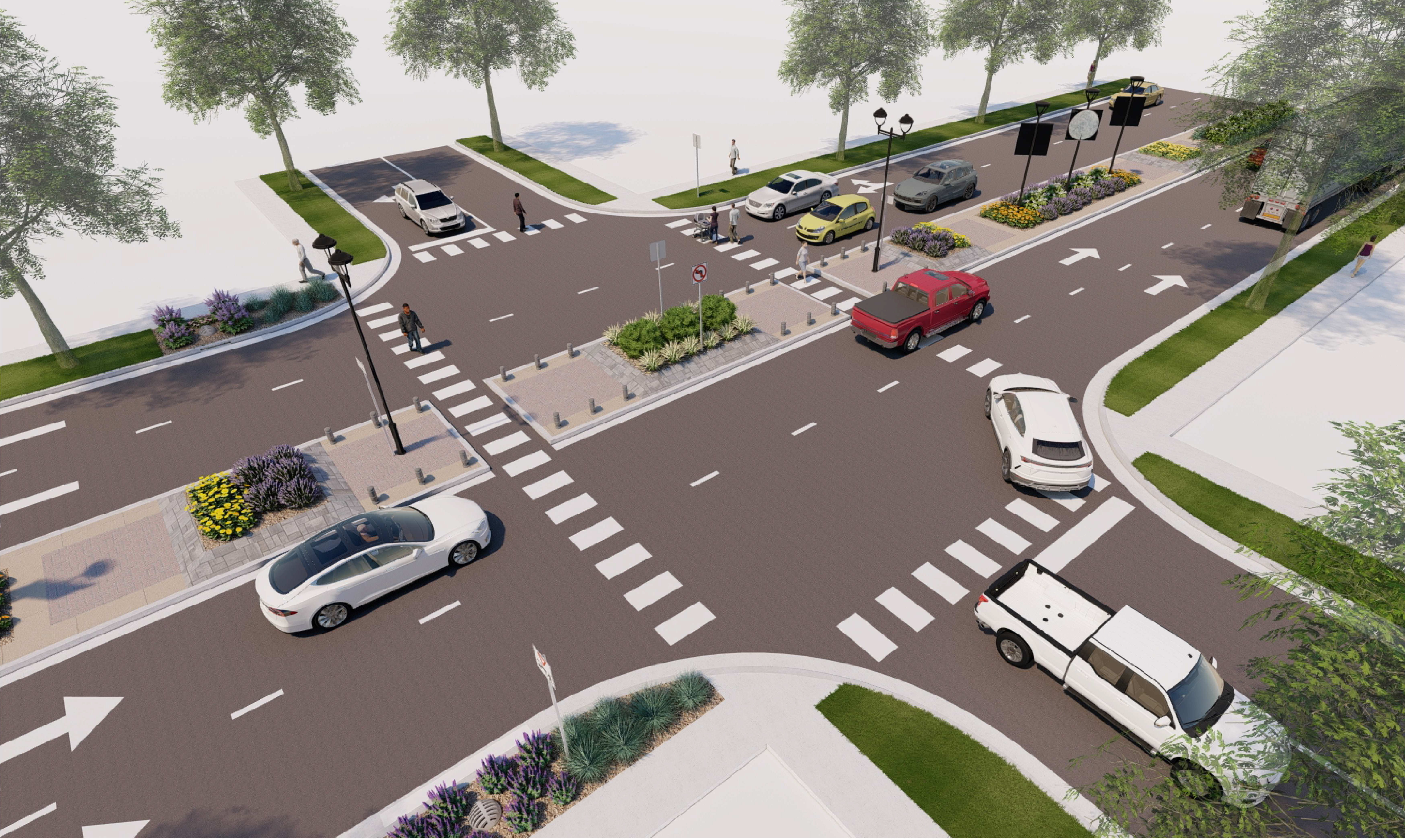
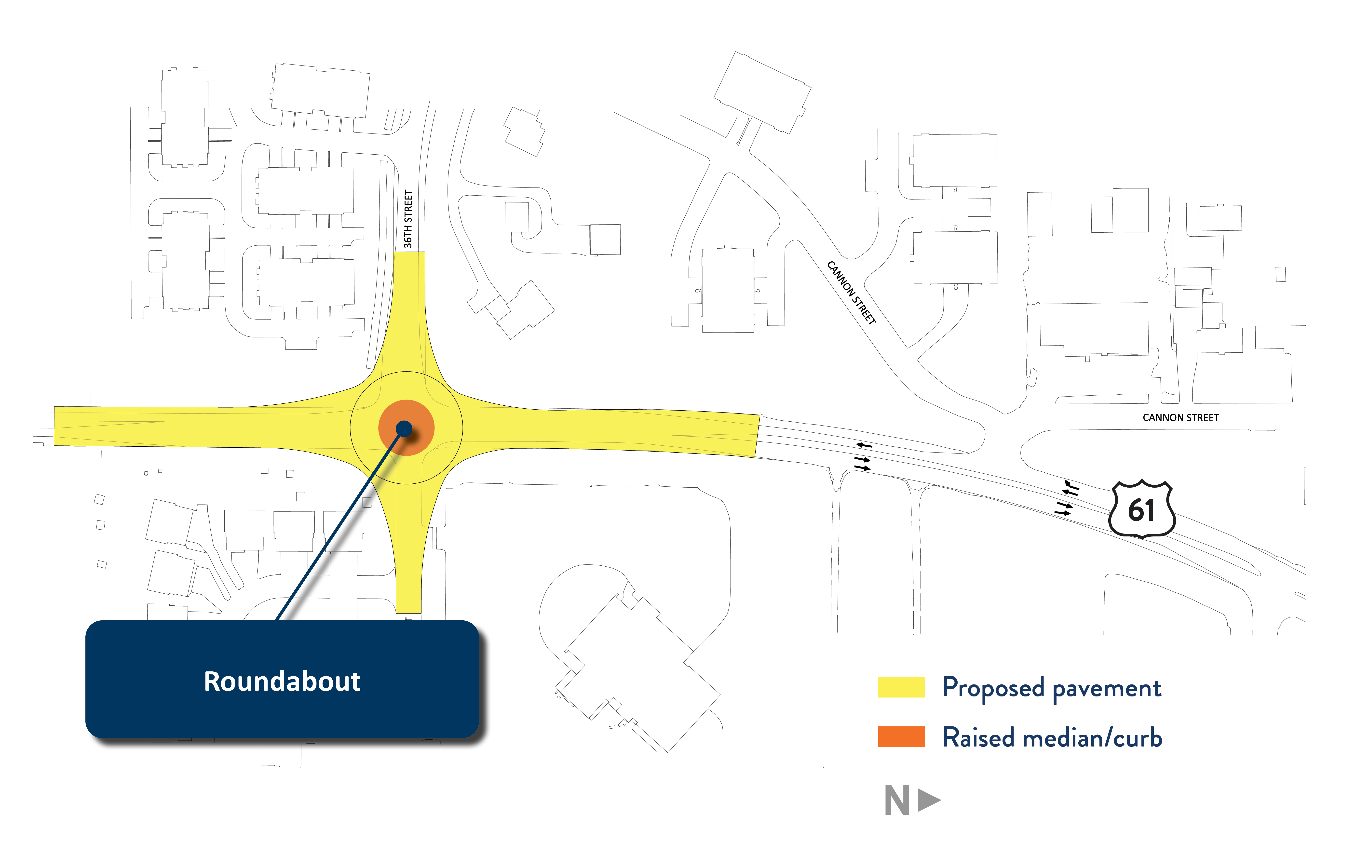
Sixth St. and Eighth St. right-in right-out concept
This concept would add center medians to help calm traffic and improve pedestrian crossings. There is a potential to reduce lane widths for more median space or other features. Concept eliminates parking on Hwy 61 to reduce conflicts and improve safety. Another option would be to limit the change to one intersection.
Fifth St. and Seventh St. right-in right-out concept
This concept shifts the medians through the Fifth and Seventh St. intersections with similar benefits and features as the concept above. As with that option, another possibility is to limit the change to one intersection.
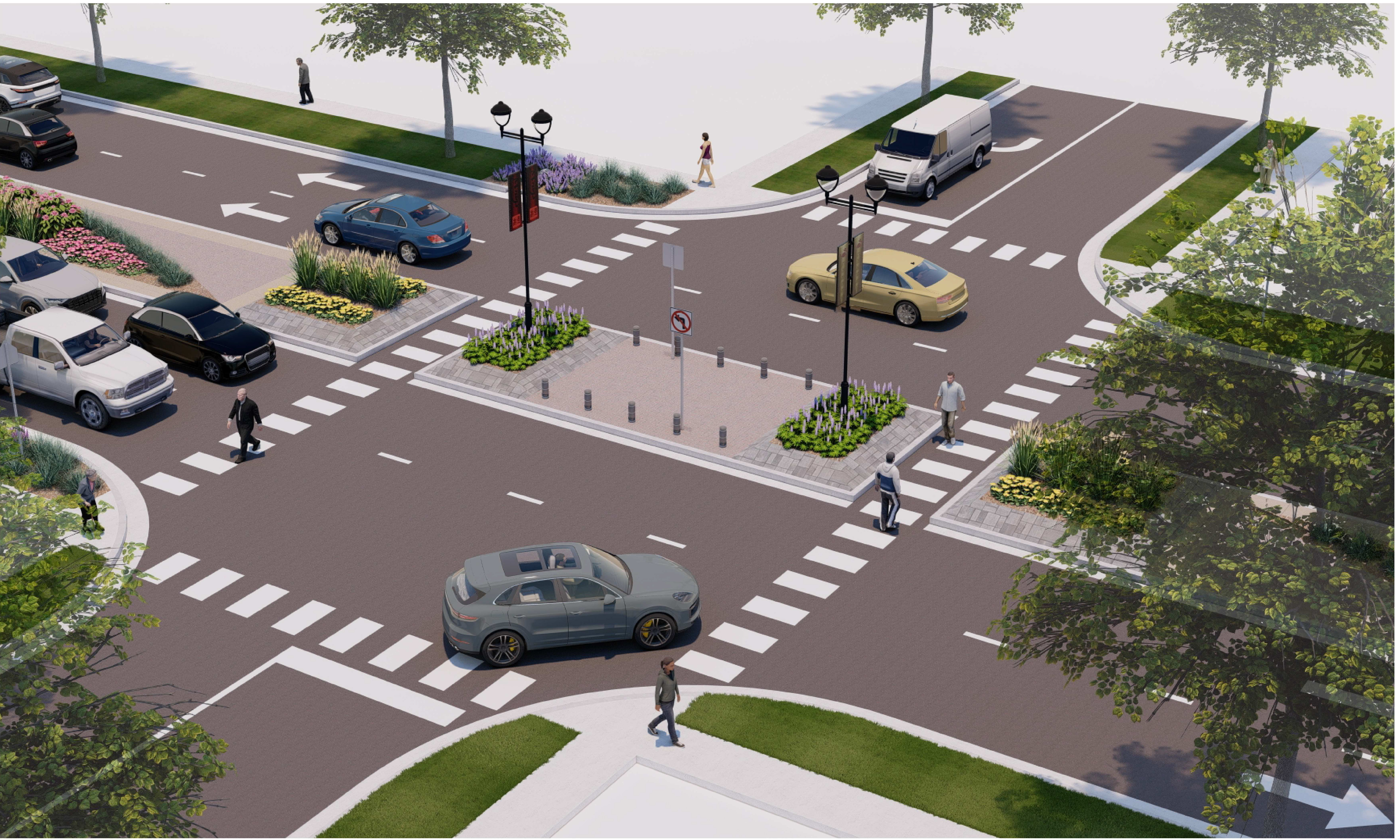
Concept renderings – example of potential improvements
The renderings below are examples of what the improvements could be.
Existing conditions
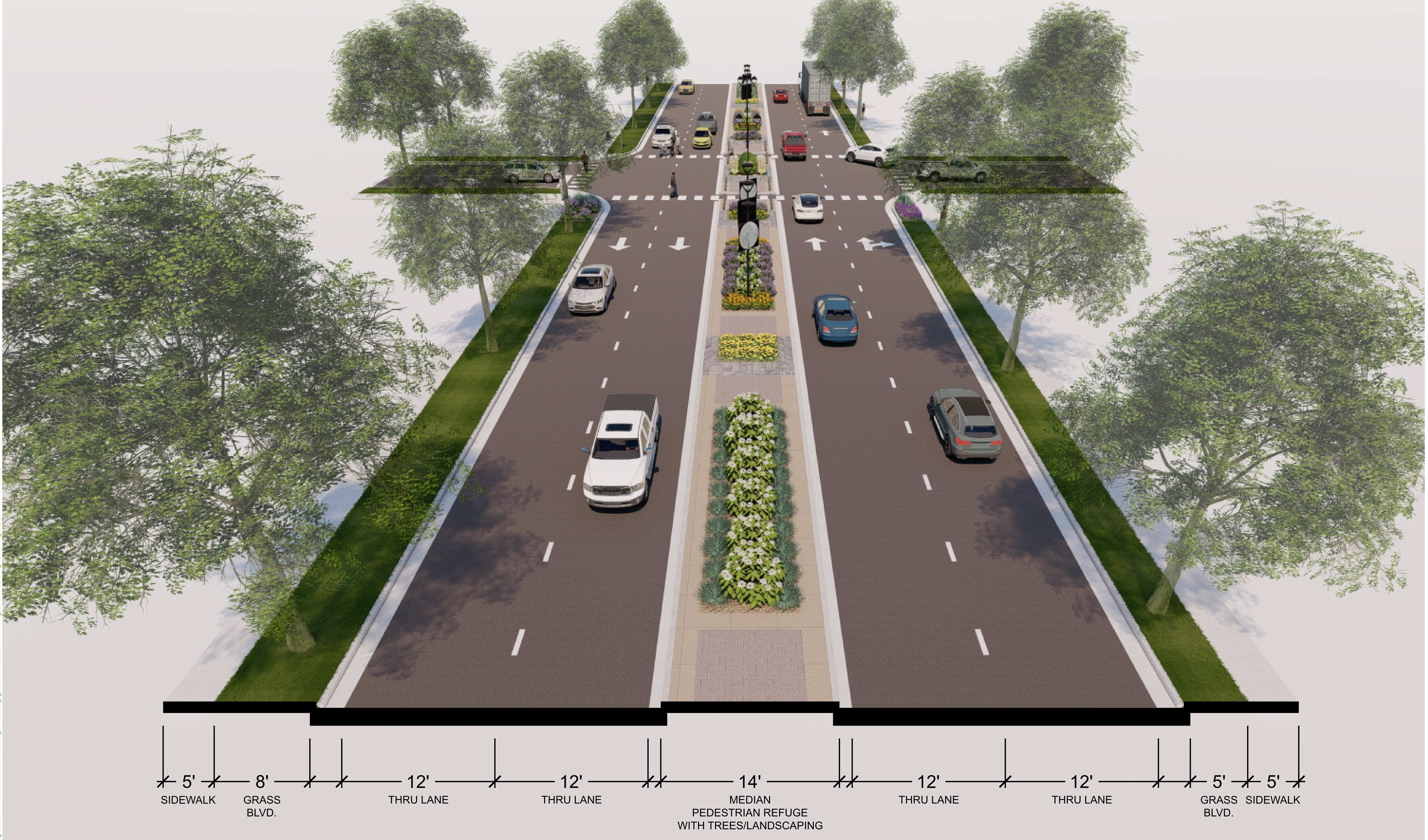
Alternative 1
Shows two 12-foot driving lanes in each direction with a center median, sidewalks, and green space boulevards.
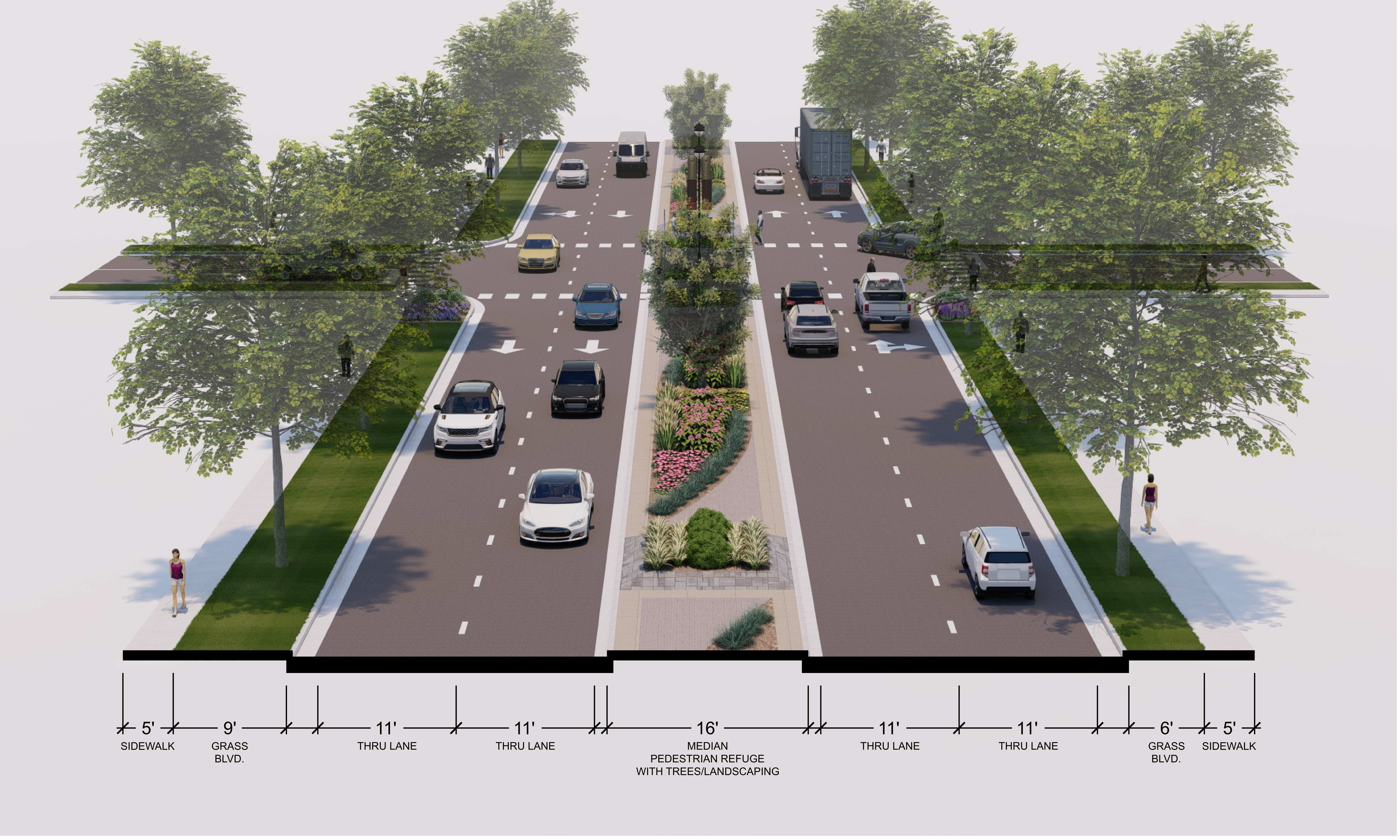
Alternative 2
Shows two 11-foot driving lanes in each direction with a center median, sidewalks, and green space boulevards.
Hwy 61 from Eighth St. to 16th St. is characterized by many businesses and related driveway access locations. A significant feature is the traffic signal combination at the 10 St. and Hwy 55 intersections. The high volume of traffic entering from Hwy 55 contributes to traffic backups at each signal. There is limited space for queuing cars waiting to turn – in particular the right turn lane from SB Hwy 61 to Hwy 55 and left turn lane from NB Hwy 61 to Hwy 55.
Concerns and opportunities that are being considered:
Improve or maintain traffic flow while also encouraging slower speeds
Manage or reduce access points to minimize conflicts among turning vehicles
Provide safer pedestrian or bicycle crossings
Improve operations at the Hwy 55 and 10th St. signals
Recognizing the Todd Field wall as an integral part of roadway design and community character
Identify potential side street impacts resulting from changes to Hwy 61 (e.g. “cut through” traffic)
Center median concept
This concept adds center medians through the 12th and 14th St. intersections. The concept also improves the SB Hwy 61 right turn lane to Hwy 55, and retains the existing signals at 10th, Hwy 55, and 15th St. intersections. The median between Hwy 55 and 10th St. is made larger by the elimination of the left turn lanes in that segment. The concept would also seek to consolidate access driveways between 12th St. and 14th St.
Close 10th St. – west side
This concept closes access to 10th St. on the west side of Hwy 61. By eliminating “through traffic” on 10th St., the effect is similar to temporary closures currently used during game day events. This concept also improves the SB Hwy 61 right turn lane to Hwy 55 and improves the pedestrian space in this area as well.
Close 10th St. – both sides
This concept closes both sides of 10th St., eliminates the signal at 10th St., and creates a new connection from the Hwy 55 intersection to 10th St. by way of Sibley St., one block east of Hwy 61.
One-way pair
This concept converts Hwy 55 and 10th St. west of Hwy 61 to a one-way pair with EB Hwy 55 only and WB 10th St. only. This concept creates the potential for pedestrian plaza space adjacent to the south side of Todd Field, and eliminates the need for a southbound right turn lane on the east side of Todd Field. Current traffic on 10th St. is approximately 2,000 vehicles per day. Traffic volume is likely to increase to over 8,000 vehicles per day on 10th St. in this concept.
Hwy 61 from 16th St. to 25th St. features many businesses and related driveway access locations. However, travel patterns through this district are notably affected by the Co. Rd. 47 intersection and nearby Hwy 316 intersection. The north end of this district features heavy truck volumes.
Concerns and opportunities that are being considered:
Maintaining appropriate spacing of signalized or roundabout intersections
Improve or maintain traffic flow while encouraging slower speeds
Manage or reduce access points to minimize safety hazards and conflicts
Provide continuity of sidewalk/trail facilities for pedestrians and bicyclists, including to/from the Vermillion River Trail
Create improvements at Co. Rd. 47 that align with Dakota County’s corridor plan
18th to 23rd Streets
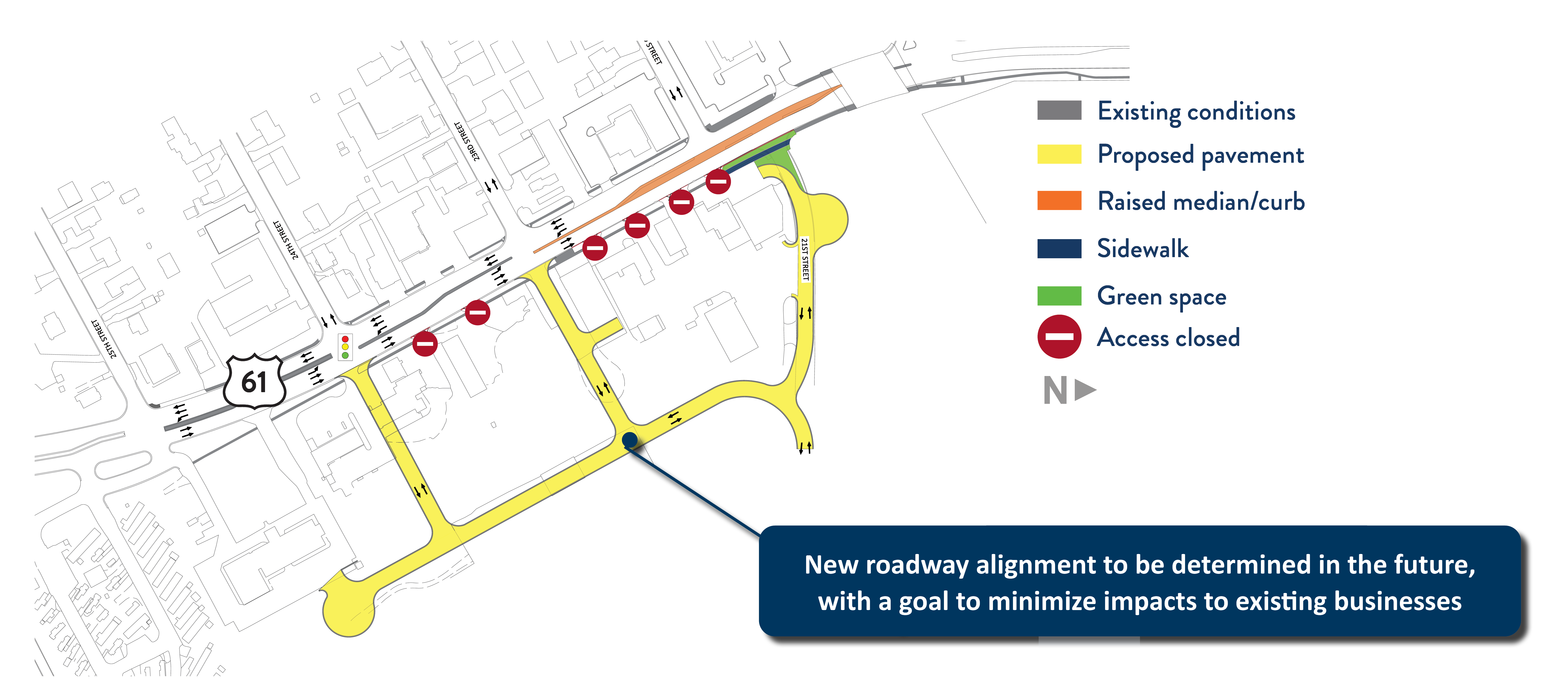
This concept combines multiple improvement opportunities in the Vermillion District. Realignment of 18th St. east of Hwy 61 is shown to improve intersection operations, and also features the potential addition of a traffic signal. This concept for the District would also eliminate parking on Hwy 61 and improve the southbound right turn lane at Co. Rd. 47. The concept includes a new pedestrian bridge over the Vermillion River (shown on the east side of the Hwy 61 bridge), Vermillion River trail connections, and closes access at 21st St. east of Hwy 61 for a new 23rd St. access and traffic signal.
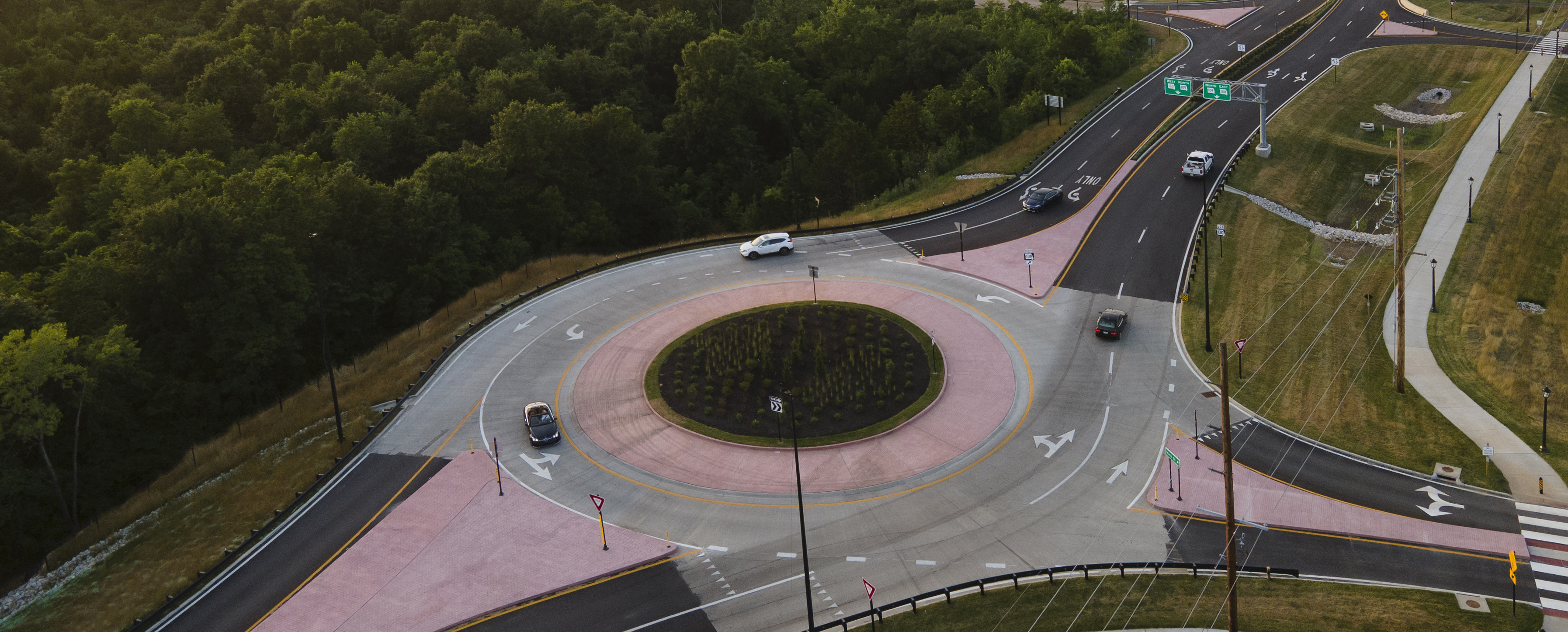
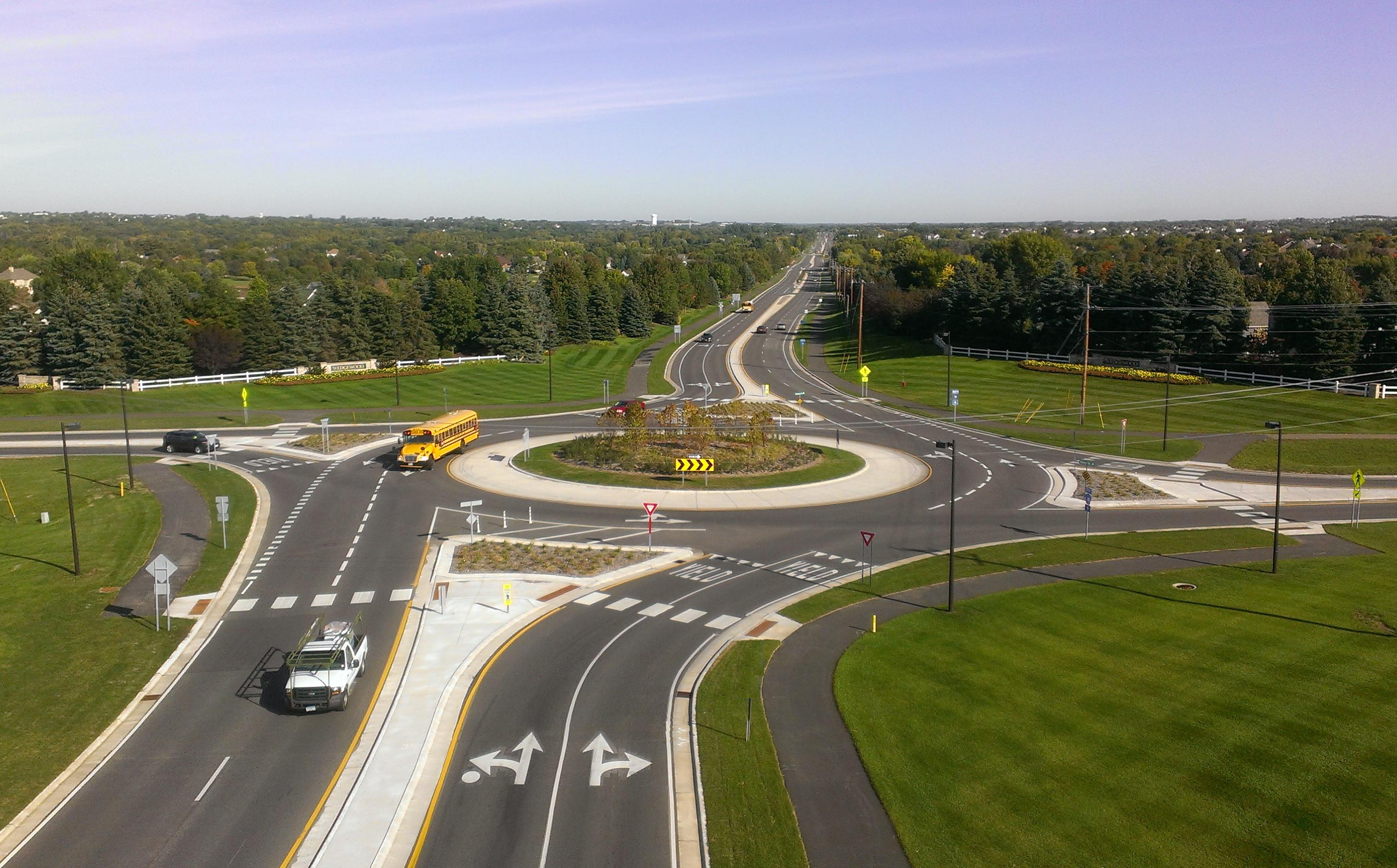
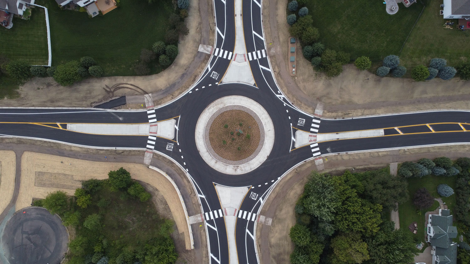
Roundabouts
These concepts show the approximate footprint to accommodate a roundabout at the 18th St., Co. Rd. 47, and 23rd St. intersections. While not indicated in the footprint, these roundabouts would feature capacity for two lanes of traffic in all directions given the high traffic volumes on Hwy 61.
18th St. roundabout Click image for larger versionCo. Rd. 47 roundabout Click image for larger version23rd St. roundabout Click image for larger versionExample roundabouts Click image for larger versionExample roundabouts Click image for larger version
21st, 23rd, and 24th St.
This concept closes 21st St., adds connections at 23rd and 24th St., consolidates access driveways, and adds a new back road east of Hwy 61. The new roadway alignment would be determined in the future with a goal to minimize impacts to existing businesses.
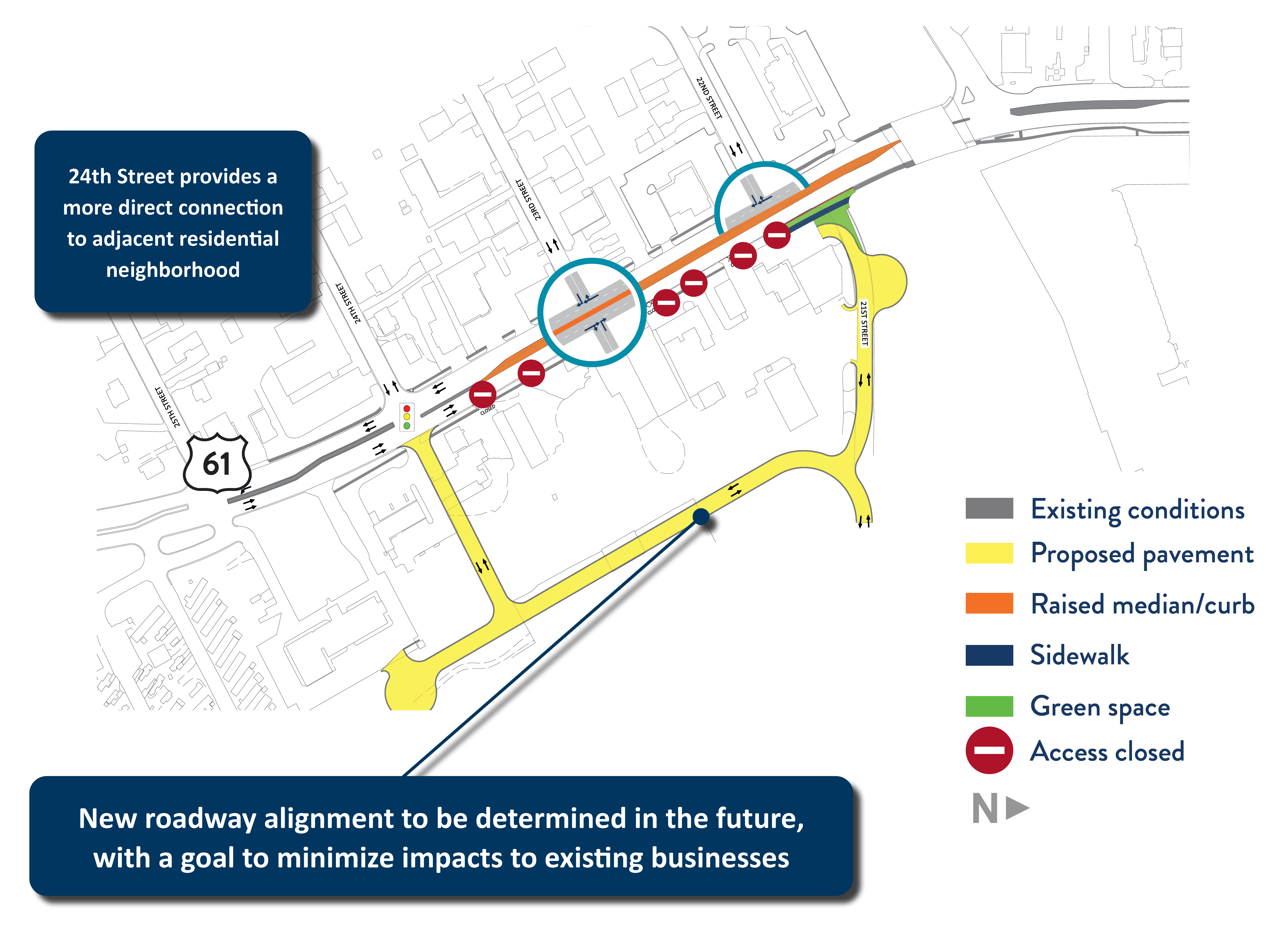
21st and 24th St.
This concept closes 21st St., adds a connection at 24th St., consolidates access driveways, and adds a new back road east of Hwy 61. The new roadway alignment would be determined in the future with a goal to minimize impacts to existing businesses. 24th St. offers the most direct route into residential neighborhoods to the west and may provide more desirable spacing of key intersections depending on the design choices at other key intersections such as Hwy 316 and Co. Rd. 47.
Hwy 61 from 25th St. to 36th St. is significantly influenced by the Hwy 316 intersection. The movements that occur at Hwy 316 affect the rest of the district. Any improvements made to the Hwy 316 intersection need to be done in consideration of the new Hwy 316 features and travel patterns. Other locations to the south have emerging concerns including the Cannon St. intersection connection with local streets and 36th St. intersection as an important community crossing for pedestrians and cyclists.
Concerns and opportunities that are being considered:
Consider long-term regional travel patterns at the Hwy 316 intersection to improve traffic operations at the intersection while also evaluating side-street impacts
Providing continuity of sidewalk/trail facilities for pedestrians and bicyclists
Evaluate long-term development patterns for potential improvements at 33rd St. and 36th St.
Consider special “Gateway” treatment at the south end to better identify this entry into the city
Improve transition from high-speed area to the south to low-speed area within the city
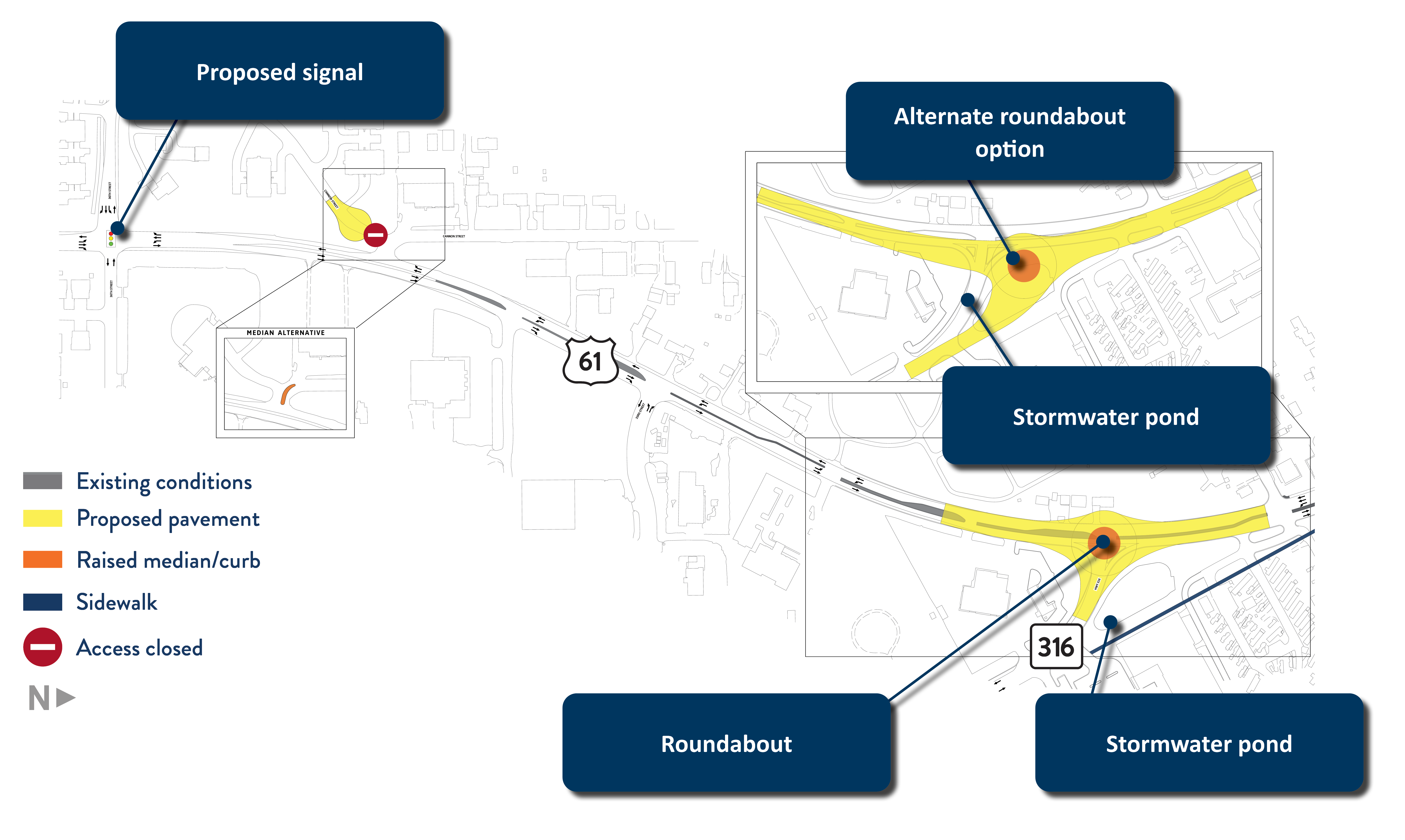
Hwy 316 roundabout
This concept includes two alternate roundabouts at the Hwy 316 intersection, a new signal at 36th St., and closed access from Cannon St. The relatively open area surrounding the Hwy 316 intersection provides design flexibility to consider or minimize impacts to adjacent properties.
Example roundabout
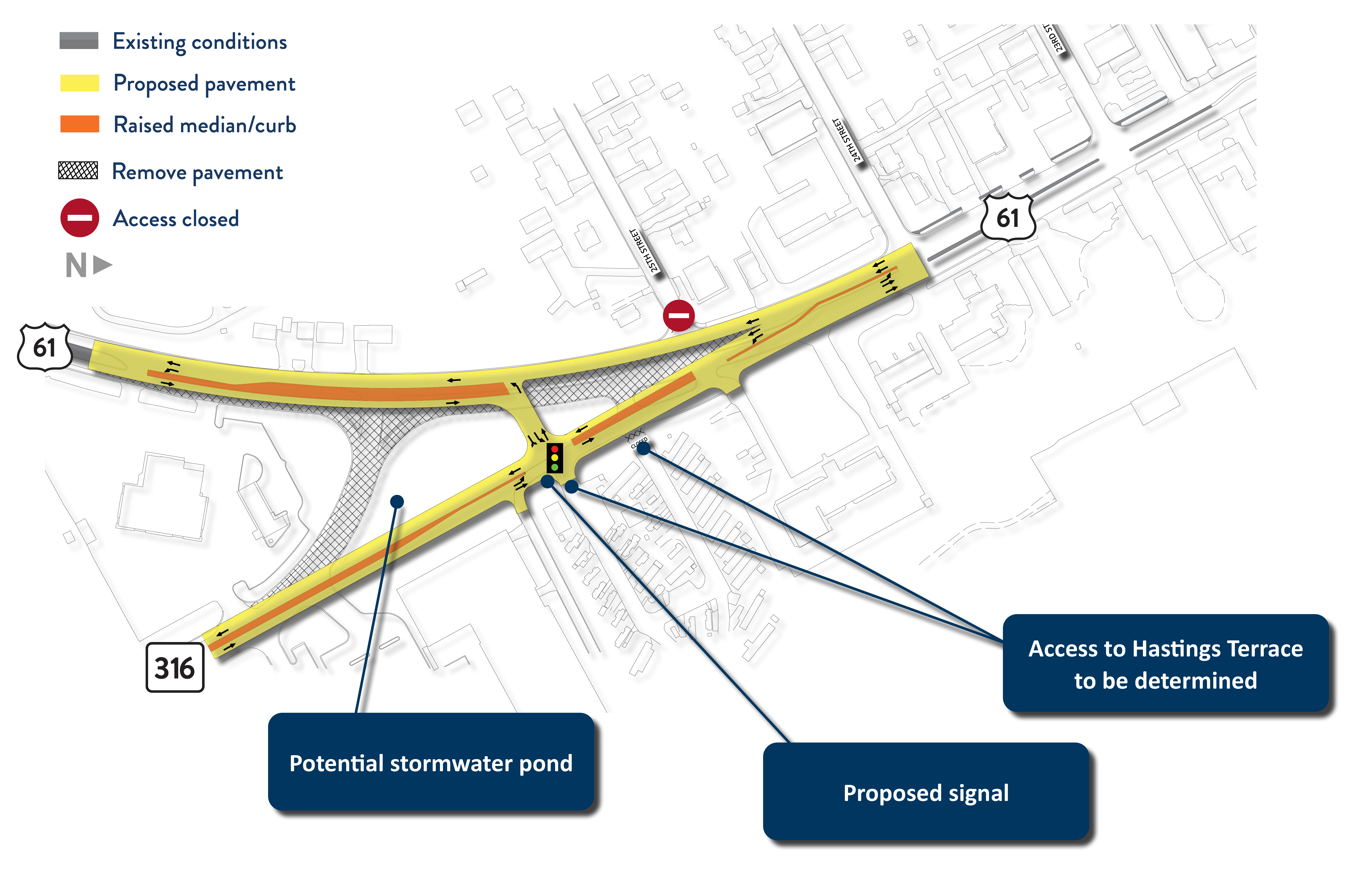
Hwy 316 direct connect
This concept includes a direct connection from Hwy 316 to Hwy 61 along a new roadway. SB Hwy 61 also maintains a direct movement while NB Hwy 61 would use a new signal to connect north of the current Hwy 61 and Hwy 316 intersection.
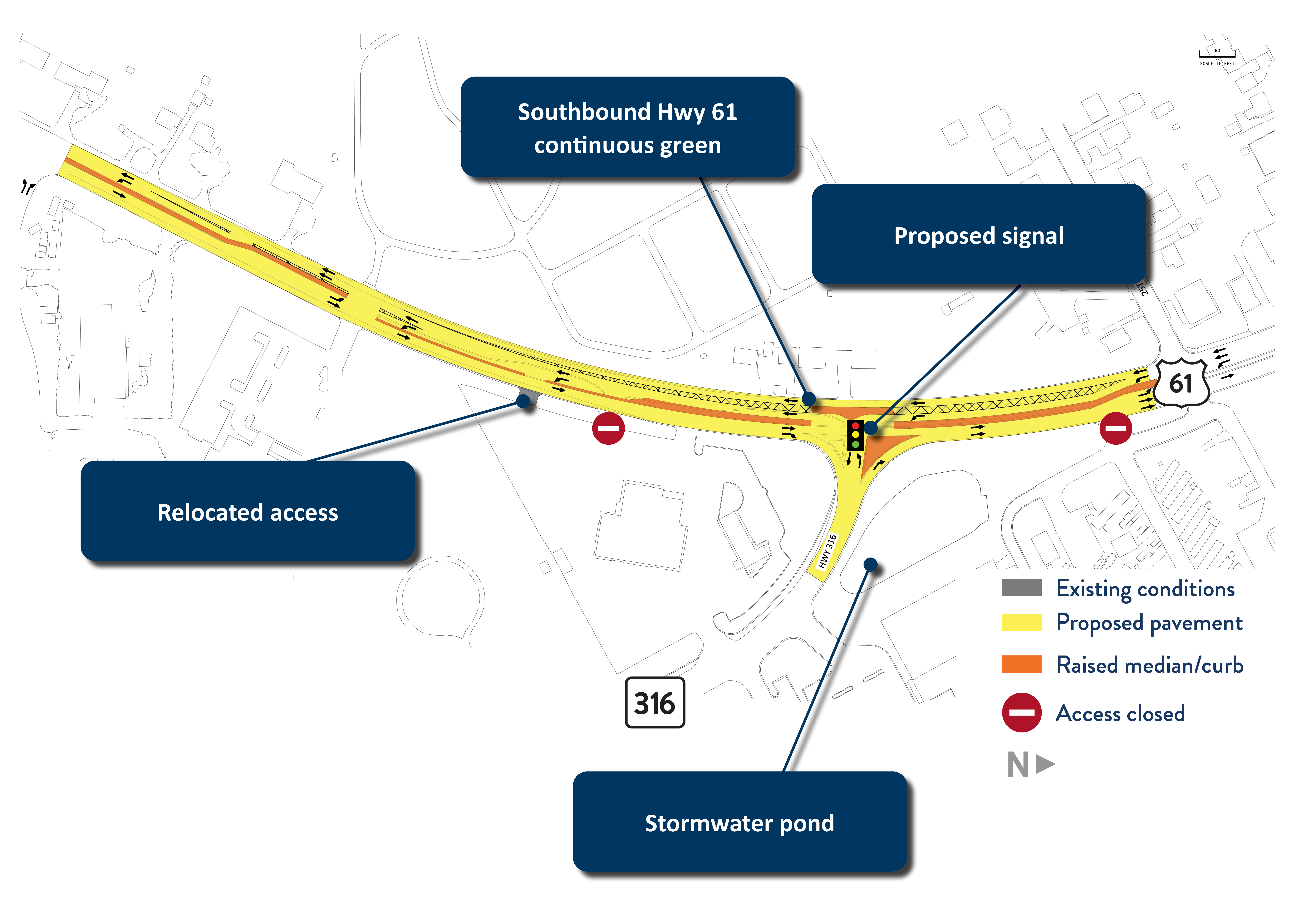
SB Hwy 61 continuous green
This concept includes a continuous green movement for SB Hwy 61 and introduces a traffic signal into the intersection at Hwy 316 to control turning movements from Hwy 61 to Hwy 316. Some modification to private access on Hwy 61 is necessary as well.
36th St. roundabout
This concept includes a roundabout at 36th St. Based on anticipated traffic volumes in the area, a single-lane roundabout is expected to provide sufficient capacity for traffic operations and helps simplify pedestrian and bike crossings at this location.
Example roundabout
This concept includes a roundabout at 36th St. Based on anticipated traffic volumes in the area, a single-lane roundabout is expected to provide sufficient capacity for traffic operations and helps simplify pedestrian and bike crossings at this location.