Minnesota Department of Transportation

511 Travel Info

Highway 61

Hastings

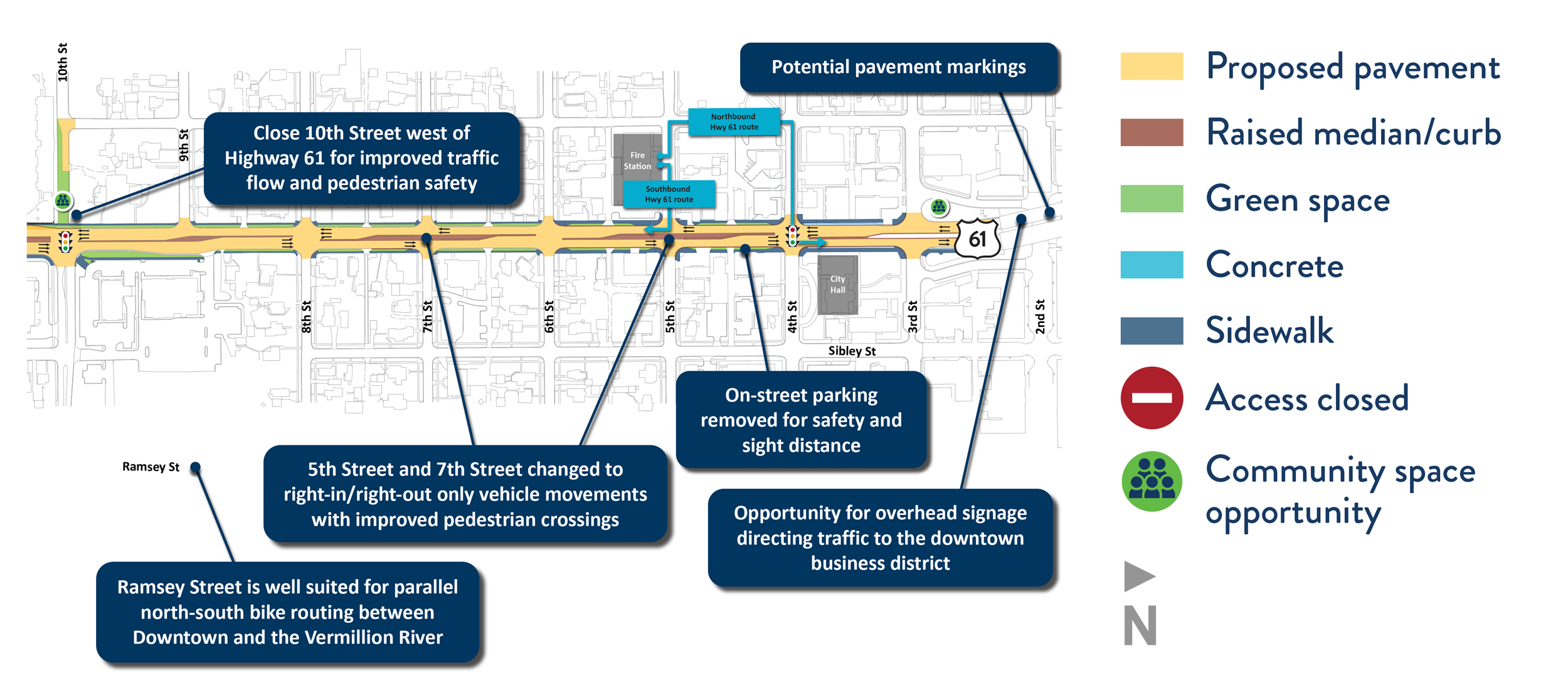
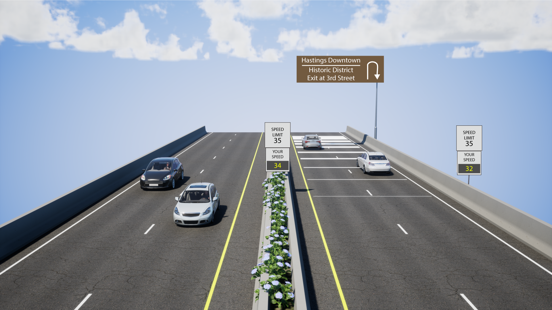
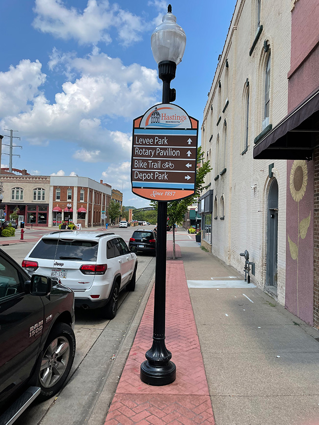
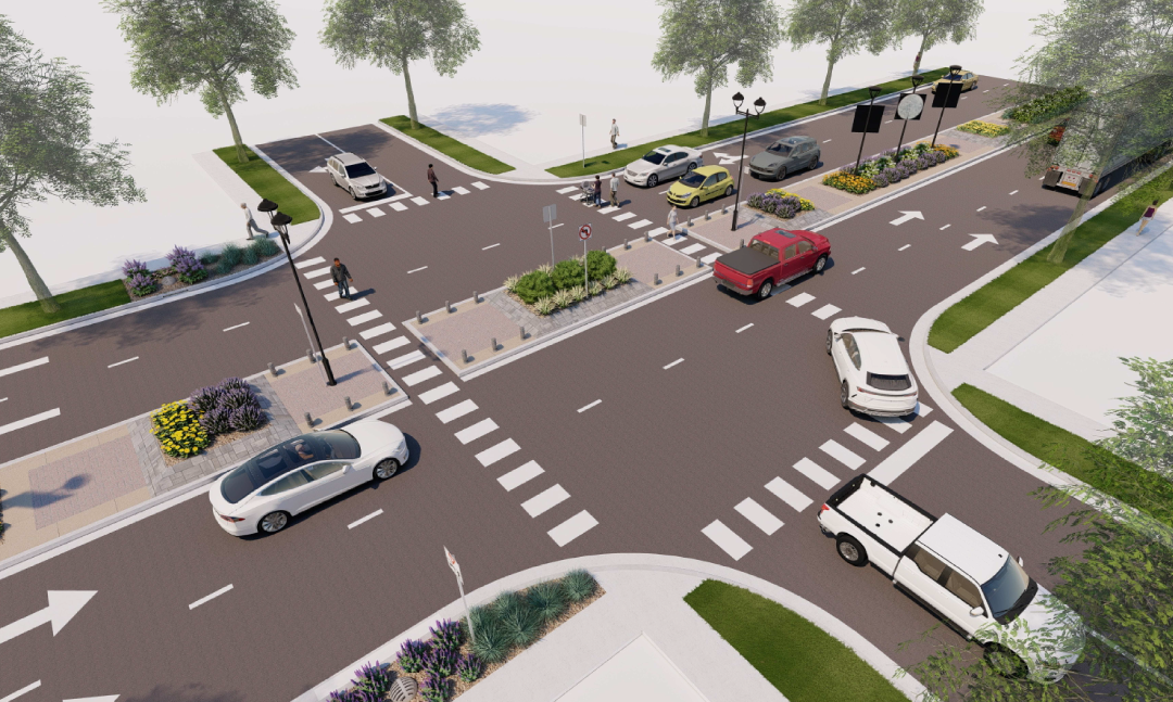
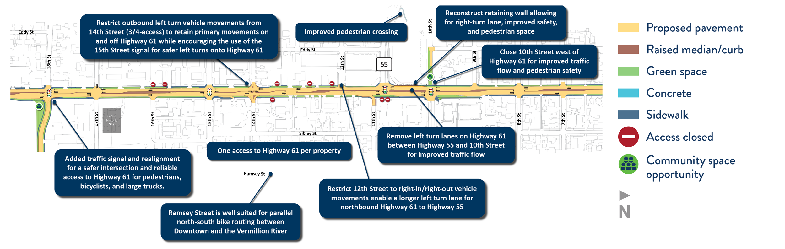
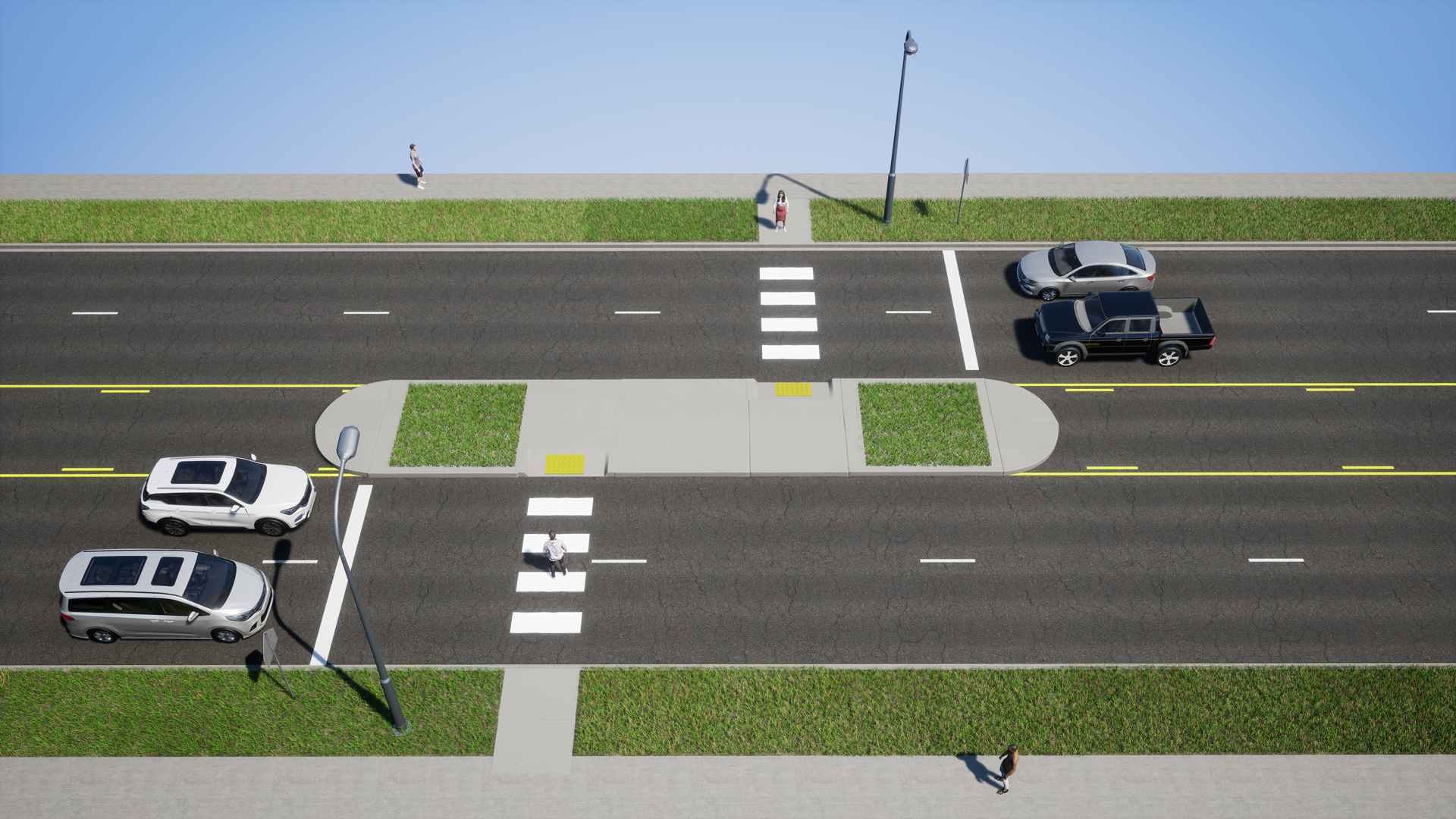
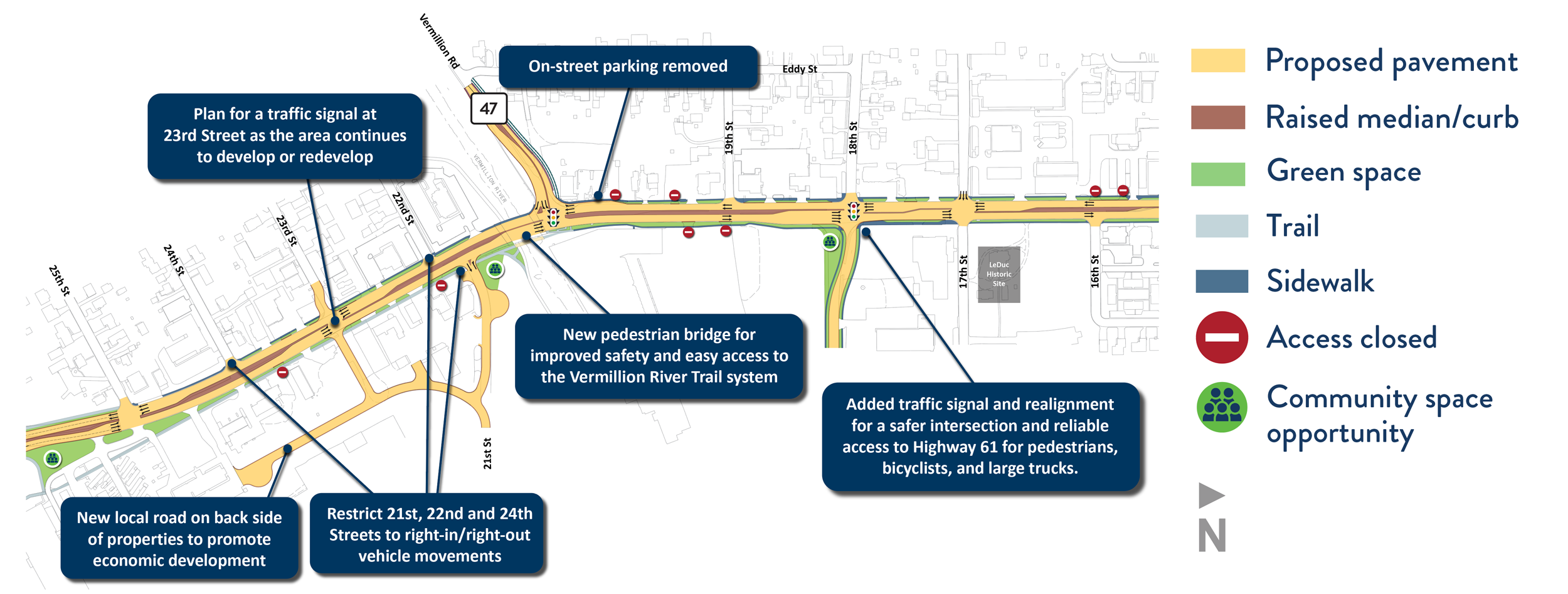
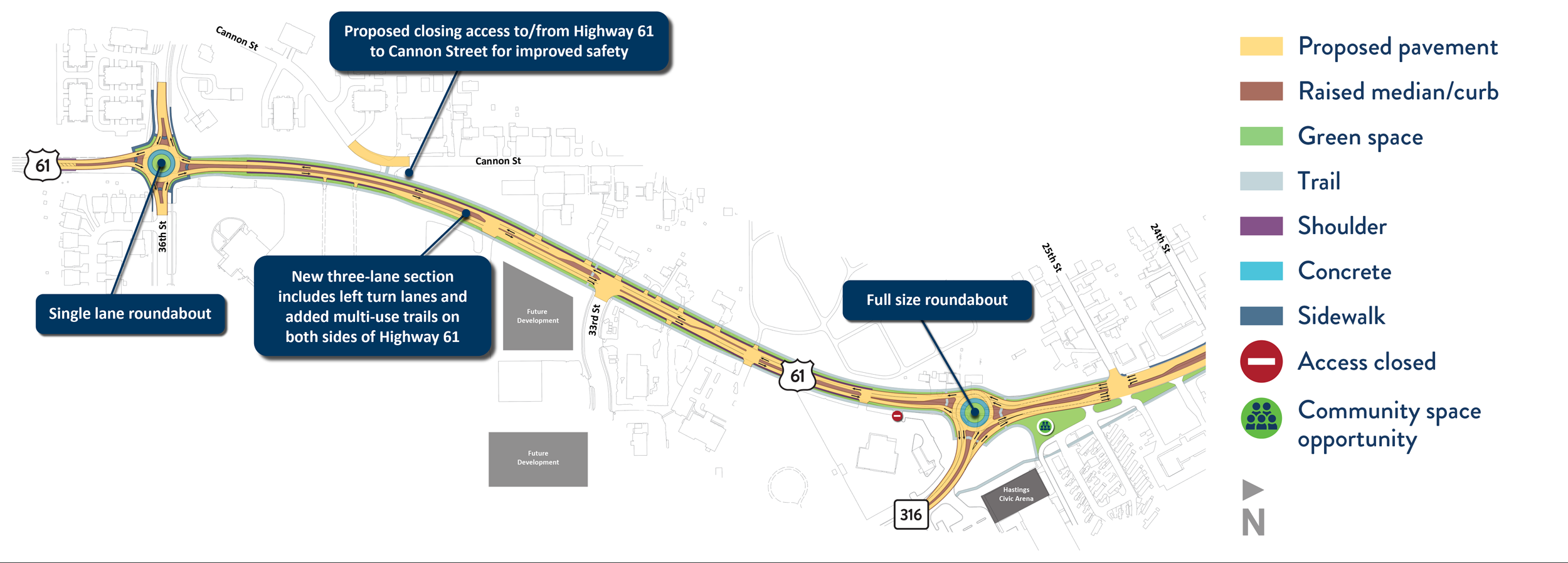
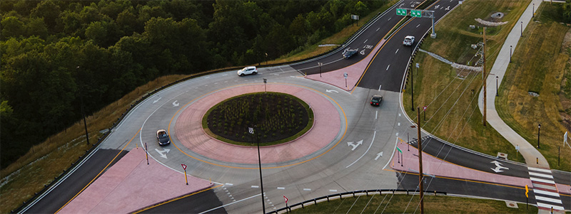
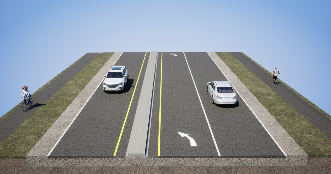
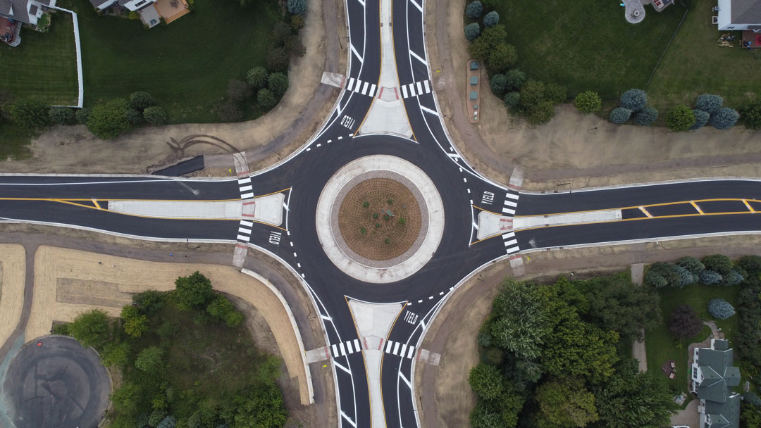
Proposed Hwy 61 alternative

What we heard

In phase two, community members shared feedback on the design concepts that reflected community experiences.

Community input was gathered by:

  • Public meeting
  • Online survey
  • Door-to-door canvassing

How we’re using feedback

Using the community feedback and technical expertise, we’ve evaluated the previous design concepts and developed the alternative presented below.
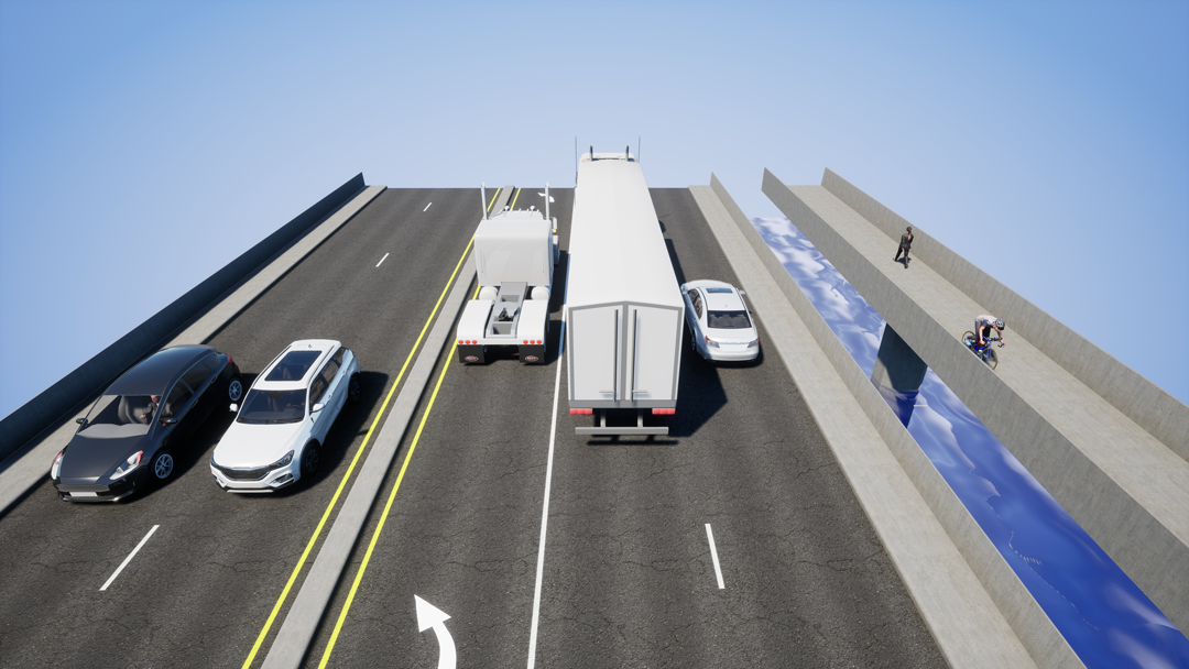
Traffic operations

Traffic operations were modeled to evaluate design concepts. Without improvements, congestion is expected to increase significantly by 2040.

Hwy 61 PM peak hour travel times
Road design Travel time for NB 36th St. to 4th St. Travel time for SB 4th St. to 36th St.
Today 4.28 minutes 4.76 minutes
2040 without improvements 5.17 minutes 21.84 minutes
Alternative presented 6.93 minutes 5.25 minutes

Proposed alternative

Vermillion Street Districts established in Vermillion Corridor Study showing downtown district from 2nd St. to 8th St., midtown district from 8th St. to south of 15th St., vermillion district from south of 15th St. to 25th St., and southtown district from 25th St. to 36th St.

The alternative is subdivided by the districts established in the Vermillion St. Corridor study (2018). The survey to provide input on these concepts is now closed.

Downtown concept

Improvements to the Hwy 61 Downtown District from 4th St. to 8th St. include:

  • Center medians
    • 5th St. and 7th St. changed to right-in/right-out only vehicle movements with improved pedestrian crossings
  • Remove all on-street parking from Hwy 61
    • Ongoing work with the City is needed to create off-street parking options for businesses
  • Potential fire station warning signs
  • Opportunity for community space at 3rd St.
  • Opportunity for overhead signage directing traffic to the downtown business district
  • Potential for additional pavement markings as southbound drivers approach 3rd St. Road markings encourage drivers to slow vehicle speeds
Highway 61 improvement concept in Downtown District
Example potential overhead signage and pavement markings
Overhead signage and pavement markings example

The design aesthetics and wayfinding could carry the existing herringbone pattern, signage, and opportunities for banner-type displays on lighting along Hwy 61.

Existing herringbone pattern
Existing Hastings colored concrete herringbone pattern example  in the historic district
Existing wayfinding signage
Existing Hastings wayfinding signage example in the historic district
Pedestrian safety at 5th St. and 7th St.
Graphical rendering of center median on Highway with improved pedestrian improvements

Midtown concept

Improvements to the Hwy 61 Midtown District from 8th St. to 18th St. include:

  • Center medians
  • Close 10th St. west of Hwy 61 for improved traffic flow and pedestrian safety
  • Reconstruct Todd Field retaining wall for improved safety and pedestrian accessibility
  • Remove left turn lanes on Hwy 61 between Hwy 55 and 10th St. for improved traffic flow
  • Restrict 12th St. to right-in/right-out vehicle movements to enable a longer left turn lane for NB Hwy 61 to Hwy 55
  • Restrict outbound left turn vehicle movements from 14th St. (3/4-access) to retain primary movements on and off Hwy 61 while encouraging the use of the 15th St. signal for safer left turns onto Hwy 61
  • Reduce or consolidate property access points
Highway 61 improvement concept in Midtown district
Hwy 61 mid-block crossing example near 12th St.
Example of a Z-path pedestrian crossing with a center median

Todd Field wall

The existing Todd Field wall was evaluated. Based on the existing wall condition, drainage issues, future maintenance concerns, and the opportunity to improve safety, traffic, and accessibility the design will construct a new wall that allows for:

  • Improved right-turn lane from SB Hwy 61 to Hwy 55
  • Improved pedestrian safety and accessibility
  • Opportunity for community space

The study team has coordinated with the Hastings School District and met with the Hastings Heritage Preservation Commission to discuss the existing wall conditions and future plan for this area.

Existing wall
Cross-section of the Todd Field wall existing design
Existing sidewalk
Existing wall and sidewalk
Concept wall
Cross-section of the Todd Field wall proposed design

Vermillion District concept

Improvements to the Hwy 61 Vermillion District from 18th St. to 25th St. include:

  • Center medians
  • Traffic signal at 18th Street to promote safe movements and crossings
  • New pedestrian bridge over the Vermillion River
  • Modifications to 21st St. and 23rd St.
    • Restrict 21st St. to right-in/right-out vehicle movements
    • New local road on back side of properties to promote economic development
    • Potential future traffic signal at 23rd St. as the area continues to develop or redevelop
Highway 61 improvement concept in Vermillion district
Pedestrian bridge over Vermillion River
Example pedestrian bridge adjacent to existing road bridge

Southtown District concept

Improvements to the Hwy 61 Southtown District from 25th St. to 36th St. include:

  • Center medians
  • Full size roundabout at Hwy 61 and Hwy 316 intersection
  • Improved pedestrian crossings
  • Trail along both sides of Hwy 61 from 36th St. to Hwy 316
  • Traditional single-lane roundabout at 36th St.
Highway 61 improvement concept in Southtown district from 25th Street to 36th Street

Hwy 61 and Hwy 316 roundabout

Full size roundabout example
Three-lane section Hwy 316 to 36th St.
Example three-lane section with concrete median
Single lane roundabout example
Example single lane roundabout

Access management

Hwy 61 in Hastings is a high-priority regional corridor through an urban core environment. Driveways and intersecting roadways can affect the safety and mobility of all users along and across Hwy 61. MnDOT’s goal is no more than one access point per property or a shift to access on local roads.

Learn more at mndot.gov/accessmanagement.

Community space

Community space could include plaza space, benches, grass and plants, or space for public art.

Example benches and plantings along the road in Grand Marais, MN
Grand Marais, MN example
Click image for larger version
Example statute along the road in Walker, MN
Walker, MN example
Click image for larger version

Example community space along the road in Walker, MN
Walker, MN example
Click image for larger version
Example building mural in Hastings, MN
Hastings example
Click image for larger version

Example bridge mural in Hastings, MN
Hastings example
Click image for larger version
Example fence with iconography in Hastings, MN
Hastings example
Click image for larger version